


Services on Demand
Journal
Article
 English (pdf)
 Article in xml format
 Article references
 Send this article by e-mail
Indicators
-
 Cited by SciELO
 -
 Access statistics
Related links
-
 Similars in
SciELO
Similars in
SciELO
Share

 Permalink
Geofísica internacional
On-line version ISSN 2954-436XPrint version ISSN 0016-7169
Geofís. Intl vol.54 n.1 Ciudad de México Jan./Mar. 2015
Original paper
Evaluation of local groundwater vulnerability based on DRASTIC index method in Lahore, Pakistan
Akhtar Malik Muhammad*, Tang Zhonghua*, Ammar Salman Dawood* and Bailey Earl**
* School of Environmental Studies, China University of Geosciences, Wuhan 388 Lumo Lu, Wuhan 430074, Hubei Province, China PRC. * Corresponding author: zhhtang@cug.edu.cn. Email: drmmakhtar@cug.edu.cn; ammar@cug.edu.cn.
** School of Resource, China University of Geosciences, Wuhan 388 Lumo Lu, Wuhan 430074, Hubei Province, China PRC. Email: earlplanner@hotmail.com.
Received: December 02, 2013.
Accepted: June 17, 2014.
Published on line: December 12, 2014.
Resumen
La evaluación de la vulnerabilidad de las aguas subterráneas muestra una extrema sensibilidad a los contaminantes antropogénicos in situ. A partir de una evaluación dicotómica (inter alia) de las características geológicas e hidrológicas fue posible determinar la vulnerabilidad de un acuífero. Se precisó que la capacidad de carga natural del acuífero puede verse seriamente comprometida con determinadas actividades humanas. La estructura y el material de la composición física de los acuíferos muestra resistencia al transporte de contaminantes desde la superficie hasta la capa freática. En la actualidad, se han planteado numerosos métodos para evaluar la vulnerabilidad del acuífero. El modelo DRASTIC utiliza algoritmos informáticos y datos hidrogeológicos dentro de un entorno de Sistema de Información Geográfica (GIS, por sus siglas en inglés) para calcular la vulnerabilidad.
El grado de vulnerabilidad de cada parámetro puede evaluarse mediante el cálculo del análisis de sensibilidad del índice DRASTIC, utilizando GIS, y muestra la contribución de cada uno de estos parámetros. El GIS se utilizó para la elaboración del mapa, el cual muestra una alta zona de riesgo del 28,8%, zonas moderadamente vulnerables del 46,3% y zonas de riesgo del 10,4%. Dentro del área de estudio, las regiones centrales mostraron una baja vulnerabilidad debido a la densidad de asentamientos humanos y el bajo nivel de agua. Sin embargo, las tierras de tipo pastos y áreas agrícolas registraron un alto riesgo.
El desarrollo ambiental y socioeconómico de Lahore depende de los políticos y los desarrolladores, y de capacidad de utilizar la información de manera efectiva para la toma de decisiones. El mapa de vulnerabilidad de las aguas subterráneas proporciona una base y está enfocada a la protección del acuífero de contaminantes. Además, el uso del suelo y las actividades de desarrollo pueden ser reportados por las variables de asignación, lo que demuestra que las zonas industriales y agrícolas son altamente vulnerables comparados con las zonas de asentamiento.
Palabras clave: Aquífero, modelo DRASTIC, GIS, aguas subterráneas, Lahore, vulnerabilidad.
Abstract
Groundwater vulnerability assessment shows an extreme sensitivity to in situ anthro-pogenic pollutants. A dichotomous assessment of geological and hydrological (inter alia) characteristics makes it possible to determine the vulnerability of an aquifer. The natural carrying capacity of aquifer can be severely compromised by human activities. The physical structure and material composition of aquifers shows resistance to contaminants transport from surface to water-table. Currently, numerous methods have been posited evaluating aquifer's vulnerability. Similarly the DRASTIC model utilizes computer algorithms and hydro-geological data within a Geographical Information System (GIS) environment to compute aquifer vulnerability.
The degree of vulnerability for each parameter can be evaluated by computing sensitivity analysis of DRASTIC index using GIS, showing the contribution of each parameter to vulnerability sensitivity. The GIS was used to developed map which showed high risk area of 28.8% and moderately vulnerable areas of 46.3% while areas of no risk were 10.4%. Central regions within the study area showed low vulnerability due to dense human settlement and low water level. However, pasture type lands and agricultural areas recorded high risk.
Lahore's environmental and socio-economic development is dependent on policy makers and planner's ability to use information effectively for decision making. The resultant groundwater vulnerability map provides a basis for this aimed at protecting the aquifer from pollutants. Additionally, land use and development activities can be informed by mapping variables, showing that industrial and agriculture areas are highly vulnerable as compare to settlement areas.
Key words: aquifer, DRASTIC model, GIS, groundwater, Lahore, vulnerability.
Introduction
In Pakistan, groundwater, is potable in its natural form and accounts for approximately ninety seven percent of total rural water supply, while nationally, accounting for fifty three percent of potable water (Solley, 1988). Groundwater is considered an important supply source for portable water, due to its relatively low susceptibility to pollution, inter alia, in comparison to surface water (United State Environmental Protection Agency, 1985). Unlike surface water that requires various pretreatment methods for domestic use, groundwater, in many cases, required little or no treatment, depending on the level of contamination. Unfortunately, both human settlement development (demographic dynamics, ignorance, improper watershed and waste management, advanced agricultural production and industrial activities etc) and physical conditions within the geological setting of most groundwater resources, threaten to compromise its quality and quantity. This relationship between groundwater quality and quantity and human settlement activities is further explored by (Baalousha, 2010), who associated contamination conditions with socioeconomic development. Public health and safety are threatened by groundwater and surface water contamination due to increases pressures from settlement development, in particular urbanisation and indiscriminate rural agricultural practices; hence, quality monitoring and conservation is essential (Baalousha, 2010).
The geological sensitivity of groundwater aquifer is defined as the possibility of percolation and diffusion of contaminants from the surface, due to run-off, into the groundwater system (Evans and Myers, 1990). One of the approaches most widely used to protect groundwater quality consists of assessing and mapping the levels of contamination to which it is susceptible. This approach is relatively old, since its first application date back to the 1970s (Albinet and Margat, 1970). The accompanying mapping exercise is undertaken on factors related to the physical environment: soil, unsaturated zone, and topology of the aquifer. Conventional methods (i.e. DRASTIC model (Aller, 1987) or the GOD model (Foster, 1987), AVI and SINTACS etc) are able to distinguish varying degrees of vulnerability at regional scales where different lithologies exist (Vias, et al., 2005). However, the most popular of these is the DRASTIC, which is an acronym of seven hydro-geological parameters which helps in defining groundwater regime and its vulnerability towards pollution. The parameters are; depth to aquifer (D), recharge (R), aquifer media (A), soil type (S), topography (T), vadose zone (I), and hydraulic conductivity (C).
The resulting thematic maps of each parameter are generated within a GIS environment. Similarly, combining DRASTIC and GIS is an efficient methods to assess groundwater vulnerability, while simultaneously assisting with its management (Babiker, et al., 2005). Each parameter in the DRASTIC model has been assigned different weight and rating value ranging from 1 to 10 based on its relative contribution to groundwater pollution. Initially developed by the US Environmental Protection Agency (USEPA) by Aller (Aller, 1987), the DRASTIC approach has now got several regional applications (Al-Zabet, 2002, Baalousha, 2006, Jamrah, et al., 2008, Merchant, 1994).
Some applications modified the DRASTIC method by adding different parameters (Secunda, et al., 1998, Wang, 2007) such as land use index, lineaments, aquifer thickness, and impact of contaminant. Still others, (Panagopoulos, et al., 2006, Secunda, Collin and Melloul, 1998), added more parameters or replacing some parameters to produce good results, such as land use index or aquifer thickness. A computer software (i.e. AHP-DRASTIC) developed by Thirumalaivasan et al. (2003) derive ratings and weights of modified DRASTIC model parameters (Thirumalaivasan, et al., 2003). Hui introduced an OREADIC model during a study in the Yinchuan Plain of China, which contains characteristics of DRASTIC model (Qian, et al., 2011). The GA-Ridge (genetic algorithm) model was developed and applied to determine the most effective hydro-geological factors influencing aquifer vulnerability (Ahn, et al., 2011). Map scales less than 1:50,000 can be assessed by using Overlay and index methods and statistical methods; however larger map scales are used in methods based on simulation models. Intrinsic aquifer vulnerability can be assessed using overlay and index methods and statistical methods. However process-based simulation models are popular for assessing specific vulnerability (Bazimenyera and Zhonghua, 2008). Parameters can be applied in Index and Overlay methods to assess groundwater vulnerability (Samake, et al., 2011).
The current paper, investigated groundwater vulnerability by modifying the DRASTIC model using GIS on the unconfined aquifer at Lahore City in Pakistan. Lahore is a totally groundwater dependent city. Therefore, it is important to identify vulnerable and expected contaminants infiltration areas. Sensitivity analysis is calculated to evaluate the model parameters. Four categories of groundwater vulnerable zones of contamination were identified. While the substantive aim of this study was to prepare groundwater vulnerability map, the more general objectives was to use the maps to assist with making informed decision on groundwater resources management, identifying and classifying contaminants and their sources, identify and classifying the intrinsic properties of the aquifer that aids in groundwater quality maintenance and identifying other factors contributing to groundwater contamination and degradation. These objectives and aim will eventually assist in decision at both the policy and planning levels to boost quality and quantity standards. As the second largest city of Pakistan, Lahore is adversely affected by uncontrolled urbanisation. Thus, it is necessary to identify the effects of these various developments on the city's groundwater resources, and find solution to reduce the stress on the aquifer.
Study area
Lahore City is located between 310-15' and 310-42' north latitude, 740-01' and 740-39' east latitude. Having an altitude ranging from 208m to 213m ASL, it is located on the alluvial plain of the left bank of Ravi River. Lahore is bordered northerly and westerly by the district of Sheikhupura, easterly by India (international border) and southerly by Kasur district (Figure 1). With a population of over 6.5million inhabitants in 2007, it is the Provincial Metropolis and the largest urban district of Punjab. It is also the second largest urban centre of Pakistan and considered to be the 24th largest city in the world.
Lahore is characterised by large seasonal variations in temperature and rainfall. Mean annual temperature is approximately 240C, ranging from 34ºC in June to 12ºC in January. Average annual rainfall is close to 575mm, varying from 300 to 1200mm (Pakistan Meteorological Department).
Approximately seventy five percent of the annual total rainfall occurs from June to September, contributing approximately 40mm to groundwater recharge in a normal year (NESPAK, 1993:Ref Gabriel and Khan, 2010). The annual potential evapotranspiration rate is 1750mm which greatly exceeds the rainfall, making irrigation for agriculture essential to supplement rainfall (NESPAK, 1993:Ref Gabriel and Khan, 2010). Daily relative humidity is higher in winter than in summer months. May and June are very hot and dry bringing frequent dust storms. Towards the end of June or beginning of July, the monsoon season starts, which is characterized by torrential rainfall and stifling humidity.
Analysis of urban demographic dynamics shows that Lahore in being metropolised to rival Punjab Province, which grew at a faster rate than the overall increase in population of the country. Therefore, water demand is increasing with urbanisation trends. Water and Sanitation Agency (WASA) has installed 316 tube wells of varying capacity in Lahore, which operate on an average of 16 - 18 hrs/day. These wells inject water directly into the main water supply system. Consequently, WASA is supplying 15.26 m3/s (290mgd) of water to 4, 31,336 connections. (Gabriel and Khan, 2010).
Geology and hydro-geological characteristics of Lahore aquifer:
The Lahore aquifer, the source of the city's groundwater, is a part of the greater Rechana Doab traversed by the Indus River. The study area is sandwiched between River Ravi and Ravi Chenab. The aquifer is composed additionally of unconsolidated alluvial complex formed by the contemporaneous filling of a subsiding trough resulting in a huge sedimentary complex of more than 400m (1300ft) in thick. Understanding the occurrence and movement of groundwater requires studying specific parts of the aquifer and also the larger contiguous aquifer constituted by the Indus River System. Although not a homogeneous and isotropic aquifer, the fine formations encountered at various depths have localized effect and do not impede the regional movement of groundwater water (NESPAK, 1993:Ref Gabriel and Khan, 2010).
The River Ravi is the main source of recharge to Lahore aquifer. Groundwater flows from a North to South direction with velocity of 1 to 1.5cm/day (Schnoor, 1996), with water level varying from 14m to 43m and dropping to 0.84m annually, due to increasing city population more water exploitation to fulfill ever increasing water demand in Lahore city (WASA, Lahore). Increasing urban and rural abstractions, for industrial, residential and agricultural uses respectively have caused decline in groundwater levels, especially within urban areas. From 1960-1987, groundwater levels have declined in parts of Lahore city by up to 15m (NESPAK, 1993:Ref Gabriel and Khan, 2010). The flow of the River Ravi is highly variable from 10 to 3000 m3/sec some times during the year.
Clay loam increases gradually with distance from riverbed (Khan, et al., 1990). There are significant changes in lithologies. The chief constituent minerals are quartz, muscovite, biotite and chlorite, in association with small percentages of heavy minerals (Greenman, et al., 1967).
Pollution sources in Lahore:
The high vulnerability of the aquifer to pollution defines the urgency for study to determine the type and nature of pollution. The Hudiara Drain is a major source of pollution for River Ravi. The heavily silted River Ravi, entering Pakistan from India, presently contributed over 47% of total municipal and industrial pollution load discharged into all the rivers in Pakistan. This silt is diluted with agriculture runoff mixing with some industrial pollutants in Pakistan (Sami, 2001).

Leakage and infiltration from irrigation canals results in a rise in the water table in Lahore. The popular practice of heavy and indiscriminate use of fertilizers and pesticides by farmers, presents a significant source of underground water pollution, as these and other agrochemicals leach from the surface soil (Lapworth, et al., 2006).
Approximately 5,700tonns of solid waste is generated daily in Lahore City from different sources, with up to 67% being organic waste. This is equivalent to a generation rate of 0.84kg/capita/day (Batool and Ch, 2009). Improper disposal from the many sources such as household, commercial activities, industrial, medical waste and animal waste are creating environmental health hazards for citizens (Shimura, et al., 2001) With particular reference to Lahore, ground water is suspected to be polluted (Ahmed, 2010) due to untreated waste water and the three dumping sites located in different parts of city. These landfill sites are informal and unplanned and have no system for leachate collection. Thus they contaminate groundwater. The presence of high levels of fecal coliform in urban underground water, suggests widespread use of improper sewage facilities (Bishop, et al., 1998). Lack of sufficient legislation and enforcement mechanisms in developing countries contributes to contamination and pollution of natural resources (Ghanbari, et al., 2011).
Study methodology
Development of the DRASTIC parameters
Aller (1987) was among the first to develop this groundwater tool in 1987. DRASTIC is an empirical groundwater model that estimates groundwater vulnerability within aquifer systems based on in situ hydro-geological information (Aller, 1987). Parameters vary with study area's geology, hydro-geology, and on data availability, analysis accuracy and development of vulnerability map by using GIS. Each hydro-geological parameter is assigned a weighting, from one to ten (Shamsuddin, 2000), according to its ability to affect groundwater. Each of the seven layers possess the ability contribute towards groundwater vulnerability evaluation (Prasad, et al., 2010). The weighting of the parameters ascribe; 1 - lowest pollution potential to 10- highest pollution potential (Table 1). Land surface, unsaturated zones and saturated zones; are three variables considered in development of DRASTIC model (Naser Ebadati 2012). The system consists of two parts: designation of mapable units and superimposing relative numerical rating system (Padagett, 1994).
The DRASTIC Index was computed by summing the weighted factors of each subdivision of the area. The DRASTIC Index is considered highly authentic and accurate when there is need for comprehensive data for hydro-geological investigations (Gogu and Dassargues, 2000, Martínez-Bastida, 2010, Massone, 2010).
The DRASTIC Index was calculated by applying linear combination of all variables with the help of equation 1. Large value for DI indicates high vulnerability of groundwater to deterioration;

or

Where D, R, A, S, T, I, and C are the parameters and r and w are the corresponding rating and weights, respectively.
A GIS database is then establishes to input data from various sources (e.g. remote sensing). The database can be used to store, manipulate and analyse data in various scales and formats ((Rahman, 2008, Sener, et al., 2009). After database creation, layers wise data was register with common coordinates system then thematic maps as well as vulnerability map develop (Voudouris, et al., 2010).
DRASTIC model parameters
Water table data is a significant data source for input in the model to assess groundwater vulnerability. The distance of water from surface to groundwater indicates level of protection and pollutants movement (Hasiniaina F, 2010). The groundwater depth indicates thickness of materials and thus the distance the pollutants need to travel (and disseminate) before it make contact with and become a part of groundwater system (Hentati, 2011). Swallow groundwater due to unconfined aquifer has high chances of being pollutant in comparison to deep aquifer. As the level of confinement reduces, contamination transportation chances will be enhance to the aquifer. Aquifer's water depth can be calculated by the following formula. DTTA (Hasiniaina F, 2010).

The recharge water has the ability to carry contaminants to the water table within the aquifer; hence a large recharge value corresponds to a high potential for groundwater pollution. For net recharge, the pollution potential of an area with confined aquifer is less than that of an unconfined one, because of the presence of a confining layer. The computation of recharge value in an aquifer is a complicated process which make it harder to ascertain (Khan, 2003). Rainfall is a significant factor which transport leachate and other surface pollutants by infiltration (Voudouris, Kazakis, Polemio and Kareklas, 2010). The values for recharge amount were generated using the estimation formula that Piscopo established in 2001 and that Al-Adamat et al. applied in 2003 for their study of the Azraq basin, Jordan;

The aquifer media ranking map was developed from an interpolation of the lithology of each borehole. Ratings of each medium represent defined characteristics of each zone. Grain size of soil (texture) can affect the infiltration rate (Voudouris, Kazakis, Polemio and Kareklas, 2010). The sand and gravel constituent of the aquifer media has a rating of 8, which is adjusted base on zone characteristics.
Soil media is considered the first line of defence against groundwater contamination. Soil collects most pollutants types due to intimate contact with human settlement (Bazimenyera et al., 2008). The nature of soil porosity and permeability are two factors, which can control infiltration process (Prasad et al., 2010). Fluid movement, decomposition process, evaporation and other chemical changes are realised on soil media. Soil permeability value and media thickness can also play significance roles in contaminant transportation.
Topography of the underlying aquifer is considered to have the lowest impact factor on vulnerability. Fluid run off capacity will increase with high slop gradient, while low slop equates to more time for infiltration (Naser Ebadati 2012). This permits high infiltration of polluted water, which enhance contaminants migration to aquifer (Bai, et al., 2011) Thus the area has a slow run-off and high percolation.
The vadose zone (VZ), have no water during the dry or summer season, however it is the most unsaturated layer above the water table, forming a significant part in measuring pollution potential (Voudouris et al., 2010). This situation is reversed in the rainy season, where the VZ is saturated. Various chemical reactions, such as biodegradation, filtration and diffusion processes take place in VZ. Saturated zones have great resistance against contamination transportation from surface to groundwater as compare to unsaturated zones (Gogu and Dassargues, 2000). This is a natural filtration and purification system of groundwater giving it low resistance and high susceptible to decay.
The Hydraulic Conductivity of an aquifer refers to its ability to transmit water. A high conductivity indicate high vulnerability while low conductivity means high resistance against contamination transportation (Rahman, 2008). A major flaw of the DRASTIC model (Voudouris et al., 2010), is its difficulty in calculating an accurate value for Hydraulic Conductivity. The C factor has control over groundwater flow; which have a close relationship with pollutants movement throughout the water table. The hydraulic conductivity can be calculated on the availability of transmissivity and aquifer thickness, based on following formula;
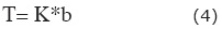
Where; T= transmissivity, K= hydraulic conductivity and b=aquifer thickness
Aquifer vulnerability assessment
Chung and Fabbri (2001), undertook a study to determine the degree of aquifer vulnerability, using the classification method. They classified the vulnerability indices based on a fixed interval of area percentage (Chung et al., 2001). After calculating vulnerability index they were then arranged in descending order and divided into classification as risk. Suitable colours were selected to represent the pixels. Aller is credit with introducing the colour coding of the vulnerability models (Aller, 1987). Assigned colours are; blue - low, green - moderate and red - high vulnerability. Colours make it easier for the vulnerability models to be interpreted. DRASTIC vulnerability index was calculated using equation 1. Value representation method is considered better to identify aquifer vulnerability of different areas. The higher the degree of DRASTIC index the greater the vulnerability of the aquifer to contamination. Qualitative risk categories can be derived from ordering the DRASTIC indices computed values into; low, moderate, high, and very high.
Sensitivity analysis
Generally, two types of sensitivity analysis tests can be computed; one is removal sensitivity analysis and the other is single parameter sensitivity analysis (Weldon, et al., 1990). By using seven parameters unperturbated vulnerability index can be obtained and perturbated vulnerability index calculated by using minimum parameters. Removal sensitivity analysis test, computes vulnerability sensitivity by eliminating one or more parameters layers using the following equation;

Where:
S= the sensitivity measure, V and V' =the unperturbated and perturbated vulnerability indices, respectively.
N and n = the number of data layers used to compute V and V'.
Sensitivity analyses examine the behavior of individual parameters towards aquifer vulnerability and present the result in the form of an analytical model (Ckakraborty, et al., 2007). Application of sensitivity analysis provides credible information on assigned rating, weight and assessing the contribution of each parameter to vulnerability (Al-Adamat, et al., 2003). This is important since other models may create errors and uncertainties of the individual parameters in output (Rosen, 1994). In previous research minimum numbers of parameters were used to develop DRASTIC model by treating some parameters as constant values (McLay et al., 2001).
Single parameter sensitivity analysis was obtained by identifying vulnerability impact of each parameter in DRASTIC model on vulnerability index. It compares the "effective" or "real" weight of each input parameter in each polygon with the "theoretical" weight assigned by the analytical model. The "effective" weight of each polygon was obtained using the following formula;

Where: W = effective weight of each parameter, Pr and Pw= the rating value and weight of each parameter and V = overall vulnerability index.
Results and discussion
Following the methodological application, thematic map of each parameter and aquifer vulnerability map were developed to evaluate groundwater deterioration vulnerability and risk. In this section, vulnerability results for each parameter are presented and discussed for Lahore City.
Water depth and Recharge
Water level in Lahore aquifer, serving the city, has decreased from 5m to 44m over the past five years. Over-exploitation of groundwater linked increasing urbanisation and many reasons such as domestic use, horticulture demand, local industries etc. An editorial in a local daily newspaper (Dawn) reported that a WASA study in 2010, which was undertaken with assistance from the Pakistan Institute of Nuclear Science and Technology (PINSTECH), an arm of the Pakistan Atomic Energy Commission, revealed that the minimum aquifer level in Lahore (main city area) reached a minimum of 21.55mASL and maximum 43.90mASL (Dawn, 2012). The unconfined nature of the Lahore aquifer contributes to its high vulnerable to pollution.
The west-south belt shows highest water table occurring between 5m to 14m, due to irrigation based recharge. The unequal distribution of groundwater resources means that water is flowing towards the Central Business District (CBD) of the city from other peripheral areas. Water flowing from other areas brings with is pollutants from rivers and from industrial areas adding to further contamination. Final water level map (Figure 3(A)) represents four respective water levels;
Level I: 5m to 14m covering 8% of the area,
Level II: 14m to 24m covering 14% of the area,
Level III: 24m to 34m covering 42% of the area, and,
Level IV: 34m to 44m covering 36% of the area.
The dense urban settlement grid of the Lahore area could possibly explain this low recharge rate in this area. Similarly, less urbanised area mean greater opportunity for surface recharging from rainfall and irrigation. Lahore aquifer depends on rainfall for groundwater recharge, however a number of other factors equally participate in the recharge process such as; River Ravi, irrigation and cultivation system, city water and sanitation system and storm water drains. National Engineering Services Pakistan (NESPAK) has computed recharge value through soil moisture and other research also used various methods. Considering the topography and lithology, the recharge rate has been computer to vary from between 0.18mm/day to 0.5mm/day. Contamination transportation from surface to aquifer depends on recharge rate (Madl-Szonyi and Fule, 1998). The water from shallow aquifer is not potable; therefore domestic water supply pumping stations go as deep as 600ft to access potable water. Three categories of recharge rates were computed in final map (Figure 3(B)), which covered an area of 9% (DRASTIC Index value 6), 17% (DRASTIC Index value 7) and 74% (DRASTIC Index value 8).
Aquifer Media
Aquifer media and constituents are the path through which water is transported to the aquifer. This can determine the flow rate and levels and types of contamination, as well as aquifer groundwater reserves. These contaminates reach the groundwater through weak soil layers within the aquifer media. The soil layers within the aquifer region recorded a high porosity due to its high sand constituent. The aquifer media has a homogeneous property which is consist of sand and gravel. Historically the area was part of the famous Indus River; therefore sand occurs in high quantities and is a major component in all layers. Uniform rating 8 was assigned for developing aquifer media map. Aquifer media for the complete area is covered with sand and gravel material.
Soil Media
The nature of the surface soil is an important factor in protecting the aquifer from contamination. During recharge this layer absorbs pollutants and influence infiltration into groundwater, thus retarding contamination. In Lahore the material in soil media is composed of silt loam, clay loam and sand, although most areas are clay loam. Rating assigned to clay loam, silt loam and sand are 3, 4 and 9 respectively, DRASTIC weight is 2 for soil media. Clay has less porosity value then sand and silt, reducing aquifer vulnerability. The highest rating is 18, which covers 13% while 6 and 8 rating occupied 68% and 18% of total area respectively. Silty loam and sand is found in the central area and west with small area, while the remaining areas are partly covered by clay loam.
Topography
Lahore's topography is generally flat and slopes towards south and south west at an average gradient of 1:3000. The slope varying from nearly flat to very gentle are assigned DRASTIC index maximum rating 9 and minimum 5, respectively. The topography layer with slopes of 0-5% covers most of the area (Figure 3C). The slope percentage increases from east-north and northwest of Lahore, in areas associated with the river. River banks have lowest slope value and percentage. Topography is assigned a rating value of 1, reflecting its low to moderate effect on groundwater vulnerability.
Impact of Vadose Zone (VZ)
The layer in the VZ has two types of material; 1) sand, silt and clay with rating 6, and 2) sand and gravel assigned rating 8. DRASTIC model assigned a value of 5 to the VZ as indication of its importance to percolation and thus aquifer contamination (vulnerability). Similarly, a DRASTIC index of 30 and 40 for the VZ impact indicates its high influence on aquifer vulnerability. Areas to the west-south and west-north side's the River Ravi are composed mainly of sand and gravel. However, central and east-south regions of Lahore have secondary category material. Impact of VZ was prepared from the lithological cross-sections obtained from the geophysical data. The VZ media is evaluated with ~51.4% (DRASTIC Index 6) of the study area covered by sand, silt and clay soils. The sand and gravel account approximately 49.6% (DRASTIC Index 8) of the study area (Figure 3D).
Hydraulic Conductivity
The hydraulic conductivity correlated with aquifer capacity to transmit water. High values mean high contamination potential. NESPAK, 1991:Ref (Gabriel and Khan, 2010) calculated average value in the area of 34.04m/day and standard deviation of 5.67m/day with minimum and maximum hydraulic conductivity values of 24.06m/day and 56.23m/day respectively. The Lahore aquifer area is divided into three categories relating to hydraulic conductivity values and assigned rating 4, 6 and 8. Hydraulic Conductivity is affected by water level and layers material. Using DRASTIC Index, calculated values for hydraulic conductivity were 1.7% (4), 19.6% (6) and 78.7% (8) in Lahore (Figure 3E). Hydraulic conductivity index values between 9 and 18 are regarded as moderate. High hydraulic conductivity represents more pollutants potential degree in DRASTIC model technique (Aller, 1987).
Vulnerability of the DRASTIC model
Considering equation 1, final computed values for DRASTIC Index provide numerical range for vulnerability criteria and aquifer vulnerability analysis. For Lahore, the DRASTIC index value degree varied from 95 to 162 divided into four categories; (1) no risk area (95–112), (2) low vulnerability (113–129), (3) moderate vulnerability (130–147), and (4) high vulnerability (148–162). These are further shown in Table 2.

Based on vulnerability, appropriate colours were applied to each category. In the final DRASTIC vulnerability map four distinct categories are represented; (1) high vulnerability - red (north and south-west of map) associated with high risk of contamination; (2) no risk - light blue (Central areas); (3) low vulnerability – dark blue ribbon, surrounding the light blue and (4) moderate vulnerability - green (north-east and south-east areas), where vulnerability is intrinsic to the aquifer's characteristics under Lahore city (Figure 3F). Vulnerability map (Figure 3F) shows that vulnerability level is low in the CBD of Lahore, due to low groundwater level and less recharge rate due to urban ground cover.
Urban density decreases with increase distance from the CBD, and thus decreasing groundwater contamination, showing the positive correlation between urbanisation and groundwater contamination. However, less populated areas and areas of irrigation represents higher degree of vulnerability. Evidently, high pollution level within the study area relates to the extent of settlement and agricultural activities. Figure 3(F) shows that total high risk area covers 28.8% of total study area. Moderate, low and no risk aquifer vulnerability areas covers 46.3%, 14.5% and 10.4% area respectively. Areas composed of high quantity of sand and silt as mentioned earlier contains high risk of contamination transportation. Sand dunes area indicates high recharge potential, shallow water level and more permeable soils, represents high and moderate aquifer vulnerability.
Sensitivity of the DRASTIC model
The statistical summaries, of the seven hydro-geological parameters calculated using the DRASTIC index, are shown in Table 3. Two parameters (topography and aquifer media) show high vulnerability degree with mean value more than 8. However recharge rate shows the lowest mean value of 2.08. Recharge rate and soil media reveal low risk aquifer contamination with mean values 2.08 and 4.27 respectively; while water depth, VZ impact and hydraulic conductivity show moderate vulnerability level with mean values 4.54, 6.99 and 6.20 respectively.
Table 3 shows water depth with highest variable value of 54.61% and aquifer media has lowest variable value zero of percentage coefficient of variance (CV). Soil media 37.06%, recharge rate 36.72% and hydraulic conductivity 22.85%, represent moderate variable, while topography 10.18% and hydraulic conductivity 14.33%, are low variable parameters.
Summary of rank order correlation analysis amongst the seven DRASTIC parameters is shown in table 4. High relationship can be seen between net recharge and hydraulic conductivity (Value of r=0.89), depth to water and hydraulic conductivity (value of r=0.73), depth to water and Recharge rate (value of r=0.71), while a weak relationship exists between hydraulic conductivity and VZ impact (value of r=0.17). The value indicating relationship between recharge and hydraulic conductivity shows that recharge rate at urban and rural area differs and greatly affects aquifer's Transmissivity. Similarly, water depth shows strong correlation with recharge and hydraulic conductivity. Table 4, identify over exploitation of groundwater, less recharge and decreasing water level at Lahore city. Only water depth and VZ impact (value of r=0.3) exposed moderate correlation, due to unsaturated material at VZ. Evidences of relatively few significant correlations at 95% confidence level (Table 4), shows that the DRASTIC parameters in Lahore Heights were generally considered independent.
Single-parameter sensitivity analysis
In single parameter sensitivity analysis section theoretical weight and effective weight of the seven parameters are compared and verify individual parameter effect on vulnerability index. Theoretical weight represents DRASTIC index weight of each parameter and effective weight assigned values by the analytical model. The "effective" weight is a function of the value of the single parameter with regard to the other six parameters as well as the weight assigned to it by the DRASTIC model (Rahman, 2008).
The DRASTIC model effective weight of seven parameters presented deviation of each parameter's theoretical weight in table 5. The research shows that the VZ impact and aquifer media possess high degree of effective weight in assessing vulnerability, with mean value of 28.17% and 19.56% respectively. Both effective weights contain higher value than theoretical weight used in developing DRASTIC model. Topography reveals an effective weight of 7.13%, compared to a low value of 4.30% for theoretical weight. However, water table, recharge rate and soil media all possess high theoretical weight with regard to effective weight. Effective weight of 14.72% for hydraulic conductivity is slightly high compared with a theoretical weight of 13%. The VZ impact and aquifer media shows the significance of obtaining accurate, detailed, and representative information about these layers.
Conclusions and recommendation
Lahore is now one of Pakistan's most rapidly urbanising cities, where like most cities in the developing world, urban management and development planning are far behind the pace of urbanisation. Most times the impacts of urbanisation are so visible on the surface that most studies simply ignore as impacts on underground resources, such as groundwater. Current research is conducted to assess aquifer vulnerability level at Lahore city by developing DRASTIC model in GIS environment. Seven hydro-geologic parameters were used to develop the final vulnerability map.
The DRASTIC Vulnerability Index was computed between 95 and 162. Based on hydro-geological field investigations and using a quintile classification method. These values were further reclassified into three classes namely high (148–162), medium (130–147), low (113–129) and no risk (95-112) vulnerable aquifer areas which cover 28.8%,46.3%, 14.5% and 10.4% of the aquifer, respectively.
Densely urbanized areas were identified having the lowest vulnerability, and less permissible to contamination transportation, while cultivation and high water level area were identified as easily polluted. It was also noticed that north-east and east-south sides has moderated vulnerability potential and west-south part contains high vulnerability degree. Central regions were more susceptible to contamination due the variation in groundwater level. Accordingly, the importance of protecting high vulnerability area and contamination sources is crucial. Topography and aquifer media are the two hydro-geological parameters calculated using the DRASTIC which show high vulnerability degree with mean value more than 8. In terms of aquifer vulnerability, vadose zone and aquifer media represent it more precisely as these both criteria provide highest weight in vulnerability assessment compared to recharge rate, water depth, VZ impact and hydraulic conductivity, which represent low to moderate values for vulnerability.
Due to high abstraction rate of groundwater, the water table has declined by approximately 0.84m yearly. As per the DRASTIC method, declining water table reduces the aquifer vulnerability; however, it enhances saltwater intrusion. Groundwater quality monitoring system must be established for regular groundwater observation and can use as prevention tool to avoid aquifer pollution.
The developed groundwater vulnerability maps can be used for groundwater assessment, water resources risk and human activities planning for future. It is also useful for water authorities and land development planner for land and groundwater resources management according to local demand. Aquifer vulnerability assessment is very important for environment, economy and social development.
The current research provides the catalyst for further investigation into the subject of groundwater quality in Lahore and cities with similar geo-hydrological conditions. These studies can be designed along similar lines as the extant research, with considerations for modifications to the DRASTIC model. The results obtained from this research, may be improved by incorporating other social, and ecological factors, as well as the use of mathematical modeling and GMS software to enhance the efficiency of the model.
Acknowledgments
We thankfully acknowledge the cooperation of Water and Sanitation Agency (WASA) Lahore, Pakistan Meteorological Department Lahore and Punjab Irrigation department for providing data and my colleague's technical assistance in developing model as well as completing the final draft.
References
Ahmed K., 2010, Impacts of Solid Waste Leachate on Groundwater and Surface Water Quality, Journal of the Chemical Society of Pakistan, 32, 606. [ Links ]
Ahn J.J., Kim Y.M., Yoo K., Park J., Oh K.J., 2011, Using GA-Ridge regression to select hydro-geological parameters influencing groundwater pollution vulnerability, Environmental monitoring and assessment, 1-9. [ Links ]
Al-Adamat R.A.N., Foster I.D.L., Baban S.M.J., 2003, Groundwater vulnerability and risk mapping for the Basaltic aquifer of the Azraq basin of Jordan using GIS, Remote sensing and DRASTIC, Applied Geography, 23, 303-324. [ Links ]
Al-Zabet T., 2002, Evaluation of aquifer vulnerability to contamination potential using the DRASTIC method, Environmental Geology, 43, 203-208. [ Links ]
Albinet M., Margat J., 1970, Cartographie de la vulnérabilité à la pollution des nappes d'eau souterraine, Bull. BRGM, 2ème série, 3,4, 13-22. [ Links ]
Aller L., Bennet T., Leher J.H., Petty R.J., Hackett G., 1987, DRASTIC: A standardized system for evaluating ground water pollution potential using hydrogeologic settings, pp 622. [ Links ]
Baalousha H., 2006, Vulnerability assessment for the Gaza Strip, Palestine using DRASTIC, Environmental Geology, 50, 405-414. [ Links ]
Baalousha H., 2010, Assessment of a groundwater quality monitoring network using vulnerability mapping and geostatistics: A case study from Heretaunga Plains, New Zealand, Agricultural Water Management, 97, 240-246. [ Links ]
Babiker I.S., Mohamed M.A.A., Hiyama T., Kato K., 2005, A GIS-based DRASTIC model for assessing aquifer vulnerability in Kakamigahara Heights, Gifu Prefecture, central Japan, Science of the Total Environment, 345, 127-140. [ Links ]
Bai L., Wang Y., Meng F., 2012, Application of DRASTIC and extension theory in the groundwater vulnerability evaluation, Water and Environment Journal, 26,3,381-391. [ Links ]
Batool S.A., Ch M.N., 2009, Municipal solid waste management in Lahore city district, Pakistan, Waste management, 29, 1971-1981. [ Links ]
Bazimenyera J.D.D., Zhonghua T., 2008, A GIS Based DRASTIC Model for Assessing Groundwater Vulnerability in Shallow Aquifer in Hangzhou-Jiaxing-Huzhou Plain, China, Research Journal of Applied Sciences, 3, 550-559. [ Links ]
Bishop P., Misstear B., White M., Harding N., 1998, Impacts of sewers on groundwater quality, Water and Environment Journal, 12, 216-223. [ Links ]
Chung C., Fabbri A., 2001, Prediction models for landslide hazard zonation using a fuzzy set approach. Geomorphology and Environmental Impact Assessment Balkema, Lisse, The Netherlands, 31-47. [ Links ]
Ckakraborty S., Paul P., Sikdar P., 2007, Assessing aquifer vulnerability to arsenic pollution using DRASTIC and GIS of North Bengal Plain: A case study of English Bazar Block, Malda District, West Bengal, India, Journal of Spatial Hydrology, 7,1. [ Links ]
Ebadati N., Motlagh K. S., Behzad N., 2012, Application of DRASTIC Model in Sensibility of Groundwater Contamination (Iranshahr–Iran) Paper presented at the 2012 International Conference on Environmental Science and Technology, Singapore 2012. [ Links ]
Evans B.M., Myers W.L., 1990, A GIS-based approach to evaluating regional groundwater pollution potential with DRASTIC, Journal of Soil and Water Conservation, 45, 242-245. [ Links ]
Foster S., 1987, Fundamental concepts in aquifer vulnerability, pollution risk and protection strategy Vulnerability of Soil and Groundwater to Pollutants, TNO Committee on Hydrogeological Research, Proceedings and Information, pp. 69-86. [ Links ]
Gabriel H., Khan S., 2010, Climate Responsive Urban Groundwater Management Options in a Stressed Aquifer System. IAHS-AISH publication: 166-168. [ Links ]
Ghanbari F., Amin S.F., Monavari M., Zaredar N., 2011, A new method for environmental site assessment of urban solid waste landfills, Environmental monitoring and assessment, 184, 1221-1230. [ Links ]
Gogu R., Dassargues A., 2000, Current trends and future challenges in groundwater vulnerability assessment using overlay and index methods, Environmental Geology, 39, 549-559. [ Links ]
Greenman D.W., Swarzenski W.V., Bennett G.D., 1967, Ground-water hydrology of the Punjab, West Pakistan, with emphasis on problems caused by canal irrigationsU S geol Surv Wat-Supply pap 1608-H U S Govt Printing Office, Washington, D.C, pp. 70. [ Links ]
Hasiniaina F.Z.J., Guoyi L., 2010, Regional assessment of groundwater vulnerability in Tamtsag basin. Mongolia using drastic model. Journal of American Science, Marsland Press, 6, 65-78. [ Links ]
Hentati I.M., Ben D.H., 2011, A statistical and geographical information system analysis for groundwater intrinsic vulnerability: a validated case study from Sfaxâ€"Agareb, Tunisia, Water and Environment Journal, 25, 400-411.
Jamrah A., Al-Futaisi A., Rajmohan N., Al-Yaroubi S., 2008, Assessment of groundwater vulnerability in the coastal region of Oman using DRASTIC index method in GIS environment, Environmental monitoring and assessment, 147, 125-138. [ Links ]
Khan A., Miura H., Prusinski J., Ilyas S., 1990, Matriconditioning of seeds to improve emergenceProceedings of The Symposium on Stand Establishment of Horticultural Crops, pp. 13-28. [ Links ]
Khan S., 2003, Investigating conjunctive water management options using a dynamic surface-groundwater modelling approach: a case study of Rechna Doab CSIRO Land and Water. [ Links ]
Lapworth D.J., Gooddy D., Stuart M., Chilton P., Cachandt G., Knapp M., Bishop S., 2006, Pesticides in groundwater: some observations on temporal and spatial trends, Water and Environment Journal, 20, 55-64. [ Links ]
Madl-Szonyi J., Fule L., 1998, Groundwater vulnerability assessment of the SW Trans-Danubian central range, Hungary, Environmental Geology, 35, 9-18. [ Links ]
Martinez-Bastida J.J., Arauzo M., Valladolid M., 2010, Intrinsic and specific vulnerability of groundwater in central Spain: the risk of nitrate pollution, Hydrogeology Journal, 18, 681-698. [ Links ]
Massone H.Q., Lo M., Martanez D., 2010, Enhanced groundwater vulnerability assessment in geological homogeneous areas: a case study from the Argentine Pampas, Hydrogeology Journal, 18, 371-379. [ Links ]
McLay C., Dragten R., Sparling G., Selvarajah N., 2001, Predicting groundwater nitrate concentrations in a region of mixed agricultural land use: a comparison of three approaches, Environmental Pollution, 115, 191-204. [ Links ]
Merchant J.W., 1994, GIS-based groundwater pollution hazard assessment: a critical review of the DRASTIC model, Photogrammetric engineering and remote sensing, 60, 1117-1128. [ Links ]
Padagett D., 1994, Using DRASTIC to improve the integrity of geographical information system data used for solid waste management facility sitting, a case study, Environ Prof, 16, 211-219. [ Links ]
Pakistan's Punjab Province Faces 50 Percent Water Shortfall, 2012, http://www.ooskanews.com/international-water-weekly/pakistan%E2%80%99s-punjab-province-faces-50-percent-water-shortfall_21820. [ Links ]
Panagopoulos G., Antonakos A., Lambrakis N., 2006, Optimization of the DRASTIC method for groundwater vulnerability assessment via the use of simple statistical methods and GIS, Hydrogeology Journal,14, 894-911. [ Links ]
Prasad R.K., Singh V., Krishnamacharyulu S.K.G., Banerjee P., 2010, Application of drastic model and GIS: for assessing vulnerability in hard rock granitic aquifer, Environmental monitoring and assessment, 176, 143-155. [ Links ]
Qian H., Li P., Howard K.W.F., Yang C., Zhang X., 2011, Assessment of groundwater vulnerability in the Yinchuan Plain, Northwest China using OREADIC, Environmental monitoring and assessment, 184, 3613-3628. [ Links ]
Rahman A., 2008, A GIS based DRASTIC model for assessing groundwater vulnerability in shallow aquifer in Aligarh, India, Applied Geography, 28, 32-53. [ Links ]
Rosen L., 1994, A study of the DRASTIC methodology with emphasis on Swedish conditions. Ground Water, 32, 278-285. [ Links ]
Samake M., Tang Z., Hlaing W., Innocent N., Kasereka K., Balogun W.O., 2011, Groundwater Vulnerability Assessment in Shallow Aquifer in Linfen Basin, Shanxi Province, China Using DRASTIC Model, Journal of Sustainable Development, 4, 53. [ Links ]
Sami F., 2001, 'Water quality monitoring of Hudiara drain', an independent consultancy for data analysis and water quality management plan. In: Department PEP (ed), Lahore.Schnoor J.L., 1996, Environmental modeling: fate and transport of pollutants in water, air, and soil, John Wiley and Sons. [ Links ]
Secunda S., Collin M., Melloul A., 1998, Groundwater vulnerability assessment using a composite model combining DRASTIC with extensive agricultural land use in Israel's Sharon region, Journal of Environmental Management, 54, 39-57. [ Links ]
Sener E., Sener S., Davraz A., 2009, Assessment of aquifer vulnerability based on GIS and DRASTIC methods: a case study of the Senirkent-Uluborlu Basin (Isparta, Turkey), Hydrogeology Journal, 17, 2023-2035. [ Links ]
Shamsuddin S., 2000, A study of groundwater pollution vulnerability using DRASTIC/GIS, West Bengal INDIA, Journal of Enviromental hydgeology, 8, 1-8. [ Links ]
Shimura S., Yokota I., Nitta Y., 2001, Research for MSW flow analysis in developing nations, Journal of Material Cycles and Waste Management, 3, 48-59. [ Links ]
Solley W., 1988, Estimated Use of Water in the United States in 1985. US Geological Survey Circular 1004, 82. [ Links ]
Thirumalaivasan D., Karmegam M., Venugopal K., 2003, AHP-DRASTIC: software for specific aquifer vulnerability assessment using DRASTIC model and GIS, Environmental Modelling & Software, 18, 645-656. [ Links ]
United State Environmental Protection Agency E., 1985, DRASTIC: a standard system for evaluating groundwater potential using hydrogeological settings, Ada, Oklahoma. [ Links ]
Vias J., Andreo B., Perles M., Carrasco F., 2005, A comparative study of four schemes for groundwater vulnerability mapping in a diffuse flow carbonate aquifer under Mediterranean climatic conditions, Environmental Geology, 47, 586-595. [ Links ]
Voudouris K., Kazakis N., Polemio M., Kareklas K., 2010, Assessment of intrinsic vulnerability using DRASTIC model and GIS in Kiti aquifer, Cyprus. European Water.
Wang Y.M., Li B.J., Ye Y., Fu H., Ihm, D.S., 2007, Vulnerability of groundwater in Quaternary aquifers to organic contaminants: a case study in Wuhan City, China, Environmental Geology, 53, 479-484. [ Links ]
Weldon A.L., Monson W., Svoboda L., 1990, Attribute error and sensitivity analysis of map operations in geographical informations systems: suitability analysis, International Journal of Geographical Information System, 4, 413-428. [ Links ]

