


Serviços Personalizados
Journal
Artigo
 texto em
  Inglês (pdf)
 Artigo em XML
 Referências do artigo
 Enviar este artigo por email
Indicadores
-
 Citado por SciELO
 -
 Acessos
Links relacionados
-
 Similares em
SciELO
Similares em
SciELO
Compartilhar

 Permalink
Revista mexicana de ciencias forestales
versão impressa ISSN 2007-1132
Rev. mex. de cienc. forestales vol.13 no.74 México Nov./Dez. 2022 Epub 09-Dez-2022
https://doi.org/10.29298/rmcf.v13i74.1274
Scientific article
Spatio-temporal analysis of wildfires occurrence in the Mexican State of Oaxaca
1
2
*
 http://orcid.org/0000-0002-5862-0056
2
http://orcid.org/0000-0002-1605-0817
1Universidad Autónoma Chapingo. México.
2Colegio de Postgraduados, Campus Montecillo. México.
In this study, we modelled and analyzed hotspot events recorded by MODIS satellite during the last nineteen years in the Mexican state of Oaxaca using a hierarchical Poisson Bayesian model. Our approach models the number of forest fires in space, time and the interaction of both and considers environmental variables. According to our results, some environmental variables can explain some of the observed Spatio-temporal variations, such as the temperature of the driest quarter, average wind speed, enhanced vegetation index values, and the occurrence of El Niño-Southern Oscillation. The analysis identified two spatial cluster regions: the first covers the Sierra Juárez up to the Isthmus of Tehuantepec, and the second covers the Sierra del Sur. Additionally, the temporal term in our model suggests that the number of events has increased by approximately 42.2 % in the last two decades. In conclusion, our results prompt that forest fires increased not only spatially but also in temporarily. These findings are alarm signals because if the trend continues, hundreds of new hectares of forest and its biodiversity will be threatened in the following decades, affecting too economic activities and people's health living in rural and urban areas of Oaxaca. This study can be a primary analysis in designing more efficient fire management programs to mitigate the impacts of altered fire regimes in Oaxaca.
Keywords Biodiversity loss; carbon emissions; hotspots; satellite observation; spatial clustering; wildfires
En este estudio, se modelan y analizan los eventos de incendios forestales registrados en los últimos 19 años por el satélite de observación MODIS en el estado de Oaxaca; para ello, se utilizó un modelo Poisson jerárquico bayesiano, el cual modela el número de incendios forestales espacial y temporalmente, así como la interacción de ambos. De acuerdo con los resultados, algunas variables ambientales como la temperatura del trimestre más seco, la velocidad media del viento, el índice de vegetación mejorado y la ocurrencia del fenómeno El Niño-Oscilación del Sur, explican parte de la variabilidad espacio-temporal observada. Derivado del análisis, se identificaron dos grupos espaciales: el primero cubre desde la Sierra Juárez hasta el Istmo de Tehuantepec, y el segundo abarca la Sierra Sur. Adicionalmente, el término temporal sugiere que el número de eventos se ha incrementado en aproximadamente 42.2 % en las últimas dos décadas. Los resultados indican que los incendios forestales se han incrementado tanto espacial como temporalmente. Estos hallazgos son señales de alarma, dado que si la tendencia continua, en las siguientes décadas cientos de nuevas hectáreas de bosque y su biodiversidad serán amenazadas a causa de los regímenes de fuego alterados, que también afectará las actividades económicas y la salud de los habitantes de las áreas rurales y urbanas del estado. La información generada puede ser un punto de partida en el diseño de programas más eficientes para mitigar el impacto de los incendios forestales en Oaxaca.
Palabras clave Pérdida de biodiversidad; emisión de carbono; focos de calor; observación satelital; agrupamiento espacial; incendios forestales
Introduction
Wildfires are one of the most critical factors that have shaped and changed our planet's ecosystem and biodiversity, starting millions of years ago. In many regions of the world, those events are caused by a combination of natural sources such as lightning and the availability of forest fire fuel caused by marked dry seasons in certain months of the year. For example, 40 % of the vegetation types in Mexico are fire-maintained (Rodríguez, 2014). In some tropical forests, fires occur every dry season and make tree species exhibit adaptive traits to fires, playing an ecological role (Nasi et al., 2002). Even more, humans are responsible for between 75 % to 96 % of them, directly or indirectly, deliberately or through carelessness (Hirschberger, 2016).
The expression of fire as an ecological factor in forest ecosystems is through fire regimes (the pattern of repeated fires expressed as frequency, season, type, severity, and areal extent in a landscape) (Scott et al., 2014). It is estimated that 61 % of the ecoregions of the planet have degraded or very degraded fire regimes, so although fire plays a crucial role in maintaining many ecosystems, because of human actions, fire is behaving differently today than at any other time in human history (Shlisky et al., 2007). On a global scale, the alteration of fire regimes is a significant source of greenhouse gas emissions. At a regional level, fires impact biomass stocks, the hydrological cycle, and people's health and may significantly affect the biodiversity in forests. According to Nasi et al. (2002), in the latter part of the twentieth century, changes in the human-fire dynamic and an increase in El Niño-Southern Oscillation frequency have led to a situation where fires are now a significant threat to many forests and the biodiversity therein. El Niño anomaly particularly leads to hot and dry conditions over many fire-prone regions globally, which can increase burned area (Burton et al., 2020). From people's health point of view, bushfire smoke can affect millions of people, constituting a major public health problem during bushfire smoke episodes (Chen et al., 2006; Dennekamp and Abramson, 2011).
Technological advancements make it possible to monitor huge areas through extensive satellite data. One application is the detection of active fires (hotspots), which is commonly based on the middle infrared (MIR) spectral region (3-5 μm) that implies a spectral radiance at the temperature of burning vegetation (500 to 1 000 K), which is higher than average Earth temperatures (300 K), efficiently discriminating the active fires (Chuvieco, 2008). The most important sensor is the Moderate-Resolution Imaging Spectroradiometer (MODIS) aboard the Aqua and Terra satellites, which identifies "fire pixels" of 1 km2 in size (on average). According to Müller et al. (2013), the size of detectable fires depends on fire temperature, area, vegetation cover and sensor viewing angle.
Observation and record of hotspots also allow researchers to study, analyze and answer scientific questions using Spatio-temporal data. The available data does not support a general increase in the burned area or global fire severity. Still, there is evidence, based on some regional scales, that there has been an increase in the number of events and the total area burned (Doerr and Santín, 2016). Therefore, it is plausible to analyze and model wildfire events regionally instead of globally. In Mexico, some research efforts have focused on understanding different aspects of wildfires from a causation (Avila-Flores et al., 2010; Antonio and Ellis, 2015; Pompa-García et al., 2018; Zúñiga-Vásquez and Pompa-García, 2019) and prediction point of view (Perez-Verdin et al., 2014; Ibarra-Montoya and Huerta-Martínez, 2016; Galván and Magaña, 2020; Monjarás-Vega et al., 2020; Ruíz-García et al., 2022).
Oaxaca is the most biodiverse state in Mexico. It harbors almost
half the plant species and vegetation types in the country, as well as 40 % of
mammal species, 63 % of birds, 26 % of reptiles and 23 % of river fish reported
for Mexico (Oviedo, 2002).
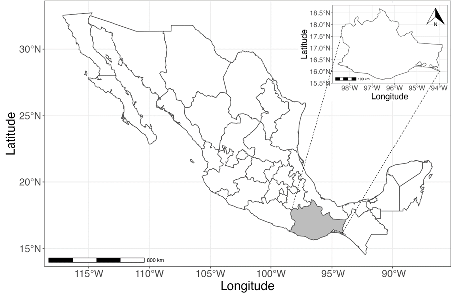
Oaxaca is located in southwestern Mexico, bordered by the
states of Puebla, Veracruz,
Chiapas and Guerrero, with the Pacific
Ocean to the south (Figure 1). The state is
crossed by tropical dry forests harboring up to 70 % of plant species living
there as endemic. According to the results obtained based on data from 2000 to
2012, Oaxaca is in the top five states with higher emissions of
black carbon (4 557-6 309 t
In this study, following the recommendation of Doerr and Santín (2016) about the need to conduct studies on local and regional scales and given the high biodiversity of Oaxaca, we analyzed the hotspot events retrospectively in the last 19 years (2001-2019) across the state of Oaxaca, Mexico. Our main goal was to explore and characterize the Spatio-temporal pattern of hotspot occurrence to investigate if hotspot patterns vary spatially and temporally across the state or whether the events are randomly dispersed in space and time. We think that hotspots are not spatially randomly distributed in our study zone. Instead, clusters are formed and can be partly explained as a function of some environmental variables such as temperature, precipitation, the slope of the terrain, wind speed and the type of vegetation. We also hypothesized a significant trend in the hotspots occurrence in space and time. Many studies have been carried out on forest fires in Mexico. Still, there has not been a unified approach that models spatially and temporarily and integrates and quantifies some environmental variables' effects on forest fire risk. Our approach can be extended in the future to include variables related to human activities that influence the hotspots distribution. As far as we know, this project is also the first to analyze hotspot data from two decades of satellite records in Oaxaca.
Material and Methods
Data and its general description
The hotspots database used in this analysis was obtained from the "Fire Information for Resource Management System-FIRMS" (NASA, 2020c). The records represent the center of a 1 km2 pixel containing one or more daily fires recorded from January 2001 to December 2019 over the state of Oaxaca, Mexico. We discarded records with a low confidence level (lower than 30 %), and all events falling into the area that comprises the Pacific Refinery (located in Tehuantepec, Oaxaca, Mexico) were considered false alarms. The polygon shapefile delimiting the state of Oaxaca was downloaded from the Conabio geo-intelligence portal (Conabio, 2020). Each cell divided the state into a regular lattice of 10 km2. The total number of hotspots' new records (not repeated) were registered in each cell for each year. This data for all the State and the nineteenth years constitute the Spatio-temporal data that were modelled through an appropriate statistical model that we discuss later.
Additionally, a database of standardised environmental (raw values minus the
average and divided by its corresponding standard deviation) variables was
generated at 1 km2 spatial resolution. This database contains
values of the Mean Temperature of the Driest Quarter
(TempDQ, °C), Mean Precipitation of the Driest Quarter
(PpDQ, mm), Mean Wind Speed
(WindSpeed, m
Statistical model
We use a Poisson hierarchical model used for spatial lattice data, which has
been used in similar applications (Boadi
et al., 2015; Costafreda, 2017), where the response variable
Where:
The second level of hierarchy links predictors (that account for fixed
effects, spatial components, time trend and time-space interaction) to
Where:
The purely spatial random effects are given by
For practical purposes, we fit the model (Equations 1 and 2) with the Bayesian statistical approach using the Integrated
Nested Laplace Approximation (INLA) (Rue et al., 2009) in the R programming
language (R Core Team, 2019).
Therefore, prior (third level of the hierarchy) distributions are needed for
all model parameters to complete the specification of the above models. For
the overall log-scale mean, we assumed a non-informative uniform prior, i.e.
Where:
The structured temporal effect is dynamically modelled using a 2nd order
random walk (RW-2):
Results and Discussion
Table 1 presents the posterior mean, the
posterior standard deviation and the posterior 95 % credible interval of each
element of (
Table 1 Summary statistics for fixed effects.
| Environmental variable | Parameter | Mean | Standard deviation | 95 % credible interval | Exp (mean) |
|---|---|---|---|---|---|
| Intercept |
|
0.153 | 0.149 | [-0.192, 0.41] | 1.165 |
| TempDQ* |
|
0.577 | 0.122 | [0.337, 0.817] | 1.781 |
| PpDQ |
|
-0.008 | 0.126 | [-0.255, 0.238] | 0.992 |
| Slope |
|
0.013 | 0.061 | [-0.106, 0.132] | 1.013 |
| WindSped* |
|
-0.348 | 0.122 | [-0.588,-0.108] | 0.706 |
| EVI* |
|
0.299 | 0.062 | [0.178,0.419] | 1.349 |
| Niño* |
|
-0.523 | 0.186 | [-0.836,-0.088] | 0.593 |
| Niña |
|
-0.248 | 0.193 | [-0.591,0.184] | 0.78 |
*Statistically significant variables.
In contrast to what is expected, an increase of one standardized unit in
WindSpeed gives 29.4 % ((1-0.706)
Figure 2 depicts the posterior mode of the
main spatial effect

Many original tropical deciduous forests in Mexico are a mix of fire-adapted and fire-sensitive tree species, and fire tends to select the former and eliminate the latter (Rodríguez et al., 2019). It is important to note that the Chimalapas jungle, a rainforest region with high biodiversity, has low spatial effect values, although the neighboring areas exhibit high values. The low values can probably be explained by the conservation efforts of the native indigenous population in that region (in 1998 -an extreme fire season in Mexico- this region was severely affected by extensive wildfires).
The second cluster goes from the southwest (adjoining the state of Guerrero) to the southeast of the state, an area that comprises the Sierra Madre del Sur. This region is made up of dry, warm forests and temperate mountain ranges, and probably high values of the main spatial effect are also due to the anthropogenic impacts. Both clusters identified in this study were also identified by Zúñiga-Vásquez et al. (2017), integrating data for the whole Mexican territory.
Table 2 presents summary statistics such
as the mean, standard deviation, and 95 % credible interval for
hyper-parameters. Computing
Table 2 Summary statistics for hyper-parameters.
| Hyper-parameter | Mean | Standard deviation | 95 % credible interval |
|---|---|---|---|
|
|
2.161 | 0.078 | [2.039,2.339] |
|
|
0.03 | 0.017 | [0.012,0.075] |
|
|
0.114 | 0.067 | [0.025,0.277] |
|
|
0.216 | 0.087 | [0.108,0.443] |
|
|
0.762 | 0.007 | [0.748,0.776] |
Figures 3a and 3b show the posterior mode of structured

Figure 3 Posterior mode and credible temporal trend interval for hotspot
events in Oaxaca, Mexico. In a) the temporally
structured effect
We depict the exceedance probabilities in Figures
4a-4d. Exceedance probabilities
are the probability that the relative rate of area

In a) for
Figure 4 Exceedance probability
The posterior mode for the space-time interaction term on the natural scale, i.e.

Conclusion
We performed a Spatio-temporal analysis of hotspot events recorded in the Mexican state of Oaxaca in the last nineteen years using data from the MODIS sensor to investigate whether forest fires are randomly dispersed throughout the state or clusters are formed. We quantified the effect in hotspots number in areal units as a function of some environmental variables, the purely spatial effect and the temporal trend using a Bayesian hierarchical Poisson model.
According to our results, environmental variables such as the mean temperature of the driest quarter, mean values of the Enhanced Vegetation Index, mean wind speed, and El Niño-Southern Oscillation occurrence can explain some of the observed spatial variations in hotspot events. From the spatial component of the statistical model, hotspots are clustered mainly throughout the Sierra Juárez and going up to the Isthmus of Tehuantepec, but also all through the Sierra del Sur (towards the coast of the state). An alarm signal was revealed from our analysis: the structured temporal term shows an increasing non-linear trend of hots-pots number across the period analyzed of about 42.2 %, altering the fire regimes even more. The Spatio-temporal interactions parameter also confirms this tendency showing that the number of events is incrementing in space and time. Suppose the increment continues in the following decades. In that case, hundreds of new hectares of forest and the species living there will be threatened, including economic activities and people's health in rural and urban areas.
This work can be a starting point for further research to understand better the spatial and temporal distribution of forest fires and altered regimes in Oaxaca. By identifying the main clusters, the Conafor can design better logistics to act with opportunity reducing the environmental and socioeconomic impacts caused by wildfires. But also, with better logistics, the economic and technical resources needed to contest wildfires can be optimized.
Exceedance probability reveals some very local regions that expect a high number of events every year (>4 in a year), it would be interesting to answer from a causation point of view why this occurs and design practical mitigation actions. The incremental temporal trend discovered here can be reverted in many ways, such as the conscientization with complete and well-planned campaigns focused on rural populations that most interact with the forest. Technical training for farmers is also needed to make agricultural practices less risky in triggering forest fires. Illegal forest exploitation and land-use change can be effectively neutralized, generating profitable rural development activities such as ecotourism, agroforestry, and the incorporation of rural communities in the programs of payments for environmental services, among other things. A possible research project could point out how to generate perdurable rural development that inhibits those activities previously mentioned. From a statistical point of view, in the future, we could extend our analysis by including additional environmental and socio-economical variables to indirectly quantify the anthropogenic effects, poverty, and social inequality in the risk of forest fires and altered fire regimes.
Acknowledges
We appreciate the support provided by the Campus Montecillo Postgraduate College in financing the publication of this article.
REFERENCES
Antonio, X. and E. A. Ellis. 2015. Forest fires and climate correlation in Mexico State: A report based on MODIS. Advances in Remote Sensing 4(4):280-286. Doi: 10.4236/ars.2015.44023. [ Links ]
Avila-Flores, D., M. Pompa-Garcia, X. Antonio-Nemiga, D. A. Rodriguez-Trejo, E. Vargas-Perez and J. Santillan-Perez. 2010. Driving factors for forest fire occurrence in Durango State of Mexico: A geospatial perspective. Chinese Geographical Science 20(6):491-497. Doi: 10.1007/s11769-010-0437-x. [ Links ]
Banerjee, S., B. P. Carlin and A. E. Gelfand. 2015. Hierarchical modeling and analysis for spatial data. Chapman and Hall/CRC Press. Boca Raton, FL, USA. 584 p. [ Links ]
Besag, J. 1974. Spatial interaction and the statistical analysis of Lattice Systems. Journal of the Royal Statistical Society, Series B (Methodological) 36(2):192-236. https://www.jstor.org/stable/2984812 . (April 2, 2020). [ Links ]
Blangiardo, M. and M. Cameletti. 2015. Spatial and Spatio-temporal Bayesian Models with R-INLA. John Wiley & Sons. Ltd. Chichester, WS, United Kingdom. 320 p. [ Links ]
Boadi, C., S. K. Harvey and A. Gyeke-dako. 2015. Modelling of fire count data: fire disaster risk in Ghana. SpringerPlus 4:794. Doi: 10.1186/s40064-015-1585-3. [ Links ]
Bravo-Cabrera, J. L., E. Azpra-Romero, V. Zarraluqui-Such and C. Gay-García. 2017. Effects of El Niño in Mexico during rainy and dry seasons: an extended treatment. Atmósfera 30(3):221-232. Doi: 10.20937/ATM.2017.30.03.03. [ Links ]
Burton, C., R. A. Betts, C. D. Jones, T. R. Feldpausch, M. Cardoso and L. O. Anderson. 2020. El Niño driven changes in global fire 2015/16. Frontiers in Earth Science 8(199):1-12. Doi: 10.3389/feart.2020.00199. [ Links ]
Chen, L., K. Verrall and S. Tong. 2006. Air particulate pollution due to bushfires and respiratory hospital admissions in Brisbane, Australia. International Journal of Environmental Health Research 16(3):181-191. Doi: 10.1080/09603120600641334. [ Links ]
Chuvieco, E. 2008. Earth observation of global change: The role of satellite remote sensing in monitoring the global environment. Springer. Dordrecht, ZH, The Netherlands. 223 p. [ Links ]
Comisión Nacional Forestal (Conafor). 2020. Cierre 2019, Reporte de Resultados de Incendios Forestales. Comisión Nacional Forestal y Secretaria de Medio Ambiente y Recursos Naturales (Semarnat). Zapopan, Jal., México. 18 p. https://www.gob.mx/cms/uploads/attachment/file/522446/Cierre_de_la_Temporada_2019.pdf . (May 5, 2021). [ Links ]
Comisión Nacional para el Conocimiento y Uso de la Biodiversidad (Conabio). 2020. Geoportal de Conabio: Sistema Nacional de Información Sobre Biodiversidad. http://geoportal.conabio.gob.mx/ . (February 17, 2021). [ Links ]
Costafreda A., S. 2017. Spatio-temporal analysis of human-caused fire occurrence patterns in Spain. Ph. D. Thesis. Departament d'Enginyeria Agroforestal, Universitat de Lleida. Lleida, CT, Spain. 150 p. http://www.tdx.cat/handle/10803/400822 . (March 31, 2020). [ Links ]
Cruz N., X., L. Villers R. and C. Gay G. 2014. Black carbon and organic carbon emissions from wildfires in Mexico. Atmósfera 27(2):165-172. Doi: 10.1016/S0187-6236(14)71107-5. [ Links ]
Dennekamp, M. and M. J. Abramson. 2011. The effects of bushfire smoke on respiratory health. Respirology 16(2):198-209. Doi: 10.1111/j.1440-1843.2010.01868.x. [ Links ]
Doerr, S. H. and C. Santín. 2016. Global trends in wildfire and its impacts: perceptions versus realities in a changing world. Philosophical Transactions of the Royal Society B Biological Sciences 371(1696):20150345. Doi: 10.1098/rstb.2015.0345. [ Links ]
Fick, S. E. and R. J. Hijmans. 2017. Worldclim 2: New 1-km spatial resolution climate surfaces for global land areas. International Journal of Climatology. http://www.worldclim.com/version2 . (January 1, 2021). [ Links ]
Galván, L. and V. Magaña. 2020. Forest fires in Mexico: an approach to estimate fire probabilities. International Journal of Wildland Fire 29(9):753-763. Doi: 10.1071/WF19057. [ Links ]
Hirschberger, P. 2016. Forests ablaze: Causes and effects of global forest fires. WWF Deutschland. Berlin, DM, Germany. 107 p. https://www.wwf.de/fileadmin/fm-wwf/Publikationen-PDF/WWF-Study-Forests-Ablaze.pdf . (May 24, 2022). [ Links ]
Ibarra-Montoya, J. L. y F. M. Huerta-Martínez. 2016. Modelado espacial de incendios: una herramienta predictiva para el Bosque La Primavera, Jalisco México. Revista Ambiente & Água An Interdisciplinary Journal of Applied Science 11(1):35-49. Doi: 10.4136/ambi-agua.1536. [ Links ]
Miranda, F. 2015. La Vegetación de Chiapas. Tomo 1. Universidad de Ciencias y Artes de Chiapas. Tuxtla Gutiérrez, Chis., México. 156 p. [ Links ]
Monjarás-Vega, N. A., C. I. Briones-Herrera, D. J. Vega-Nieva, E. Calleros-Flores, … and W. M. Jolly. 2020. Predicting forest fire kernel density at multiple scales with geographically weighted regression in Mexico. Science of the Total Environment 718(4):137313. Doi: 10.1016/j.scitotenv.2020.137313. [ Links ]
Müller, D., S. Suess, A. A. Hoffmann and G. Buchholz. 2013. The value of satellite-based active fire data for monitoring, reporting and verification of REDD+ in the Lao PDR. Human Ecology 41(1):7-20. Doi: 10.1007/s10745-013-9565-0. [ Links ]
Nasi, R., R. Dennis, E. Meijaard, G. Applegate and P. Moore. 2002. Forest fire and biological diversity. Unasylva: An International Journal of Forestry and Forest Industries 53(209):36-40. https://www.researchgate.net/publication/232660153_Forest_fire_and_biological_diversity . (May 24, 2022). [ Links ]
National Aeronautics and Space Administration (NASA). 2020a. Application for Extracting and Exploring Analysis Ready Samples (AppEEARS). https://appeears.earthdatacloud.nasa.gov/ . (May 24, 2020). [ Links ]
National Aeronautics and Space Administration (NASA). 2020b. EarthData. https://urs.earthdata.nasa.gov . (November 20, 2020). [ Links ]
National Aeronautics and Space Administration (NASA). 2020c. FIRMS Fire Information for Resource Management System. https://firms.modaps.eosdis.nasa.gov . (December 12, 2020). [ Links ]
Oviedo, G. 2002. The Community Protected Natural Areas in the State of Oaxaca, Mexico. WWF-Gland. Zuerich, ZH, Switzerland. 36 p. http://awsassets.panda.org/downloads/02_community_protected_areas_oaxaca.pdf . (June 12, 2021). [ Links ]
Perez-Verdin, G., M. A. Marquez-Linares and M. Salmeron-Macias. 2014. Spatial heterogeneity of factors influencing forest fires size in northern Mexico. Journal of Forestry Research 25(2):291-300. Doi: 10.1007/s11676-014-0460-3. [ Links ]
Pompa-García, M., J. J. Camarero, D. A. Rodríguez-Trejo and D. J. Vega-Nieva. 2018. Drought and spatiotemporal variability of forest fires across Mexico. Chinese Geographical Science 28(1):25-37. Doi: 10.1007/s11769-017-0928-0. [ Links ]
R Core Team. 2019. R: A Language and Environment for Statistical Computing (v. 3.6.1). The R Foundation for Statistical Computing. Vienna, Austria. https://www.R-project.org/ . (June, 2020). [ Links ]
Rodríguez T., D. A. 2014. Incendios de Vegetación. Su ecología, manejo e historia. Vol. 1. Colegio de Postgraduados. Guadalajara, Jal., México. 891 p. [ Links ]
Rodríguez T., D. A., P. Martínez M. y P. J. Martínez L. 2019. Efectos del fuego en el arbolado de un bosque tropical de pino y en el de una selva baja caducifolia en Villaflores, Chiapas. Ciencia Florestal 29(3):1033-1047. Doi: 10.5902/1980509833952. [ Links ]
Rue, H., S. Martino and N. Chopin. 2009. Approximate Bayesian inference for latent Gaussian models by using integrated nested Laplace approximations. Journal of the Royal Statistical Society. Series B Statistical Methodology 71(2):319-392. Doi: 10.1111/j.1467-9868.2008.00700.x. [ Links ]
Ruíz-García, V. H., M. A. Borja-de la Rosa, J. D. Gómez-Díaz, C. Asensio-Grima, M. Matías-Ramos and A. I. Monterroso-Rivas. 2022. Forest fires, land use changes and their impact on hydrological balance in temperate forest of Central Mexico. Water 14(3):383-402. Doi: 10.3390/w14030383. [ Links ]
Scott, A. C., D. M. J. S. Bowman, W. J. Bond, S. J. Pyne and M. E. Alexander. 2014. Fire on Earth: An Introduction. Wiley Blackwell. Chichester, WS, United Kingdom. 434 p. [ Links ]
Senande-Rivera, M., D. Insua-Costa and G. Miguez-Macho. 2022. Spatial and temporal expansion of global wildland fire activity in response to climate change. Nature Communications 13:1208-1216. Doi: 10.1038/s41467-022-28835-2. [ Links ]
Shlisky, A., J. Waugh, P. Gonzales, M. Gonzalez, … and W. Fulks. 2007. Fire, Ecosystems and People: Threats and strategies for global biodiversity conservation. GFI Technical Report 2007-2. The Nature Conservancy. Arlington, VA, USA. 26 p. https://www.conservationgateway.org/Files/Documents/fire_ecosystems_and_people.pdf . (January 17, 2020). [ Links ]
Zúñiga-Vásquez, J. M. and M. Pompa-García. 2019. The occurrence of forest fires in Mexico presents an altitudinal tendency: a geospatial analysis. Natural Hazards 96(1):213-224. Doi: 10.1007/s11069-018-3537-z. [ Links ]
Zúñiga-Vásquez, J. M. , D. Cisneros-González, M. Pompa-García, D. A. Rodríguez-Trejo and G. Pérez-Verdín. 2017. Spatial modeling of forest fires in Mexico: an integration of two data sources. Bosques 38(3):563-574. Doi: 10.4067/S0717-92002017000300014. [ Links ]
Received: May 19, 2022; Accepted: September 30, 2022
 Este es un artículo publicado en acceso abierto bajo una licencia
Creative Commons
Este es un artículo publicado en acceso abierto bajo una licencia
Creative Commons
