


Serviços Personalizados
Journal
Artigo
 texto em
  Inglês (pdf)
 Artigo em XML
 Referências do artigo
 Enviar este artigo por email
Indicadores
-
 Citado por SciELO
 -
 Acessos
Links relacionados
-
 Similares em
SciELO
Similares em
SciELO
Compartilhar

 Permalink
Revista mexicana de ciencias agrícolas
versão impressa ISSN 2007-0934
Rev. Mex. Cienc. Agríc vol.7 spe 13 Texcoco Jan./Fev. 2016
Articles
Adaptation of coastal vulnerability model in the coast of Tabasco to climate change
1 El Colegio de la Frontera Sur-LAIGE. Carretera Villahermosa-Reforma, km 15.5 s/n. Ranchería Guineo, 2 Sección, C. P. 86280, Villahermosa, Tabasco. Tel: 52 993 313 6110. (rramos@ecosur.mx; jnunez@ecosur.edu.mx)
2 División Académica de Ciencias Biológicas- Universidad Juárez Autónoma de Tabasco, Carretera Villahermosa- Cárdenas, km 0.5 s/n. C. P. 86040, Villahermosa, Tabasco, México.
3 División de Académica de Ciencias Biológicas-Universidad Juárez Autónoma de Tabasco. Carretera Villahermosa-Cárdenas, km 0.5 s/n. C.P. 86040, Villahermosa, Tabasco, México. Tel. +52 993 3544308. (lillygama@yahoo.com; hhtrejo@gmail.com).
4 Universidad Juárez Autónoma de Tabasco- División de Académica de Ciencias Agropecuarias. Carretera Villahermosa-Teapa, km 25, Ranchería La huasteca, Municipio del Centro, Tabasco, C. P. 86040, México. (rusaher@hotmail.com).
5 Campo Experimental Pabellón-INIFAP. Carretera Aguascalientes-Zacatecas, km. 32.5. 20660. Pabellón de Arteaga, Aguascalientes. (ruiz.osias@inifap.gob.mx).
Coastal areas face drastically the effect of climate change (CC), for its geographical location are prone to erosion and flooding, causing loss of land and crops near to the coast, reducing the distribution of natural and cultivated species. The sea level rise (INM) is caused by CC, which increases the vulnerability of coastal community’s worldwide. Coastal vulnerability index (IVC) is a methodology based on a complex set of coastal factors that identify the risk of a specific danger. The objective was to analyze the compatibility and adaptability of IVC in the coast of Tabasco, to the effects of climate change. Based on a literature review, accurate data on the potential impacts of INM in the state of Tabasco are obtained. It is concluded that the approach of IVC is possible to apply considering variables that contribute to the adaptation of the coast, such as coastal geomorphology, coastal slope, sea level rise, changes in the coastline, waves and tidal range. In the particular case of Tabasco coast, sedimentation and subsidence variables can strengthen the prediction of the impacts from INM. The lack of information on some variables is a limitation on the application of IVC on the coast of Tabasco, although it is feasible to make adaptations to the model, because depending on local coastal features, some variables influence more or less in the accuracy of the information obtained.
Keywords: coastal erosion; flooding; sea level rise and coast
Las zonas costeras enfrentan drásticamente el efecto del cambio climático (CC), por su ubicación geográfica son propensas a erosión e inundación, provocando pérdida de tierras y cultivos agrícolas cercanos a la costa, reduciendo la distribución de especies naturales y cultivadas. El incremento del nivel del mar (INM) es un efecto provocado por el CC, que incrementa la vulnerabilidad de las comunidades costeras en el mundo. El índice de vulnerabilidad costera (IVC), es una metodología basada en un complejo conjunto de factores costeros que identifican el riesgo de un peligro en específico. El objetivo fue analizar la compatibilidad y adaptabilidad del IVC en el litoral tabasqueño, ante los efectos del cambio climático. Con base en una revisión bibliográfica, se obtienen datos precisos sobre los impactos potenciales del INM en el estado de Tabasco. Se concluye que el enfoque del IVC es posible aplicarlo considerando variables que contribuyen a la adaptación de la costa, como es la geomorfología costera, pendiente costera, aumento del nivel del mar, cambio en la línea de costa, oleaje y rango mareal. En el caso particular del litoral tabasqueño, las variables sedimentación y subsidencia puede robustecer la predicción de los impactos del INM. La falta de información de algunas variables, es una limitación en la aplicación del IVC en la costa de Tabasco, aunque es factible realizar adaptaciones al modelo, debido a que dependiendo de las características costeras locales, algunas variables influyen en mayor o menor grado en la precisión de la información obtenida.
Palabras clave: erosión costera; inundación; incremento del nivel del mar y costa
Introduction
Coastal zones are the first land portion facing extreme events attributed to climate change (CC) such as, intense hurricanes, severe flooding (both temporary and permanent) and sea level rise (INM) (Bijlsma et al., 1996; Sheik and Chandrasekhar, 2011). The occurrence of these weather events will cause loss of coast being eroded and flooded (Nicholls, 2002), causing irreversible changes in mangrove ecology (Finlayson et al., 2013; Junk et al., 2013) and losses of agricultural crops near the coast (Turner et al., 1996). In this context, the implications of CC are of concern, especially because in Mexico, coastal areas are of economic importance for the country (Lara et al., 2008).
There is a high probability that the number and magnitude of extreme weather events will increase in the future, but at the same time it is expected that the methods and tools provide alternatives for adaptation and mitigation to CC (ONU/EIRD, 2008). The INM will affect coastal areas from the country, being the most vulnerable the Gulf of Mexico and Caribbean Sea, where the coast of Tabasco stands for its high vulnerability (SEMARNAP, 1997), suffering great impacts on agriculture (IPCC, 2007).
Vulnerability and its impact on the economy of the countries with coastlines make necessary to assess INM and at the same time to formulate response strategies that are coupled with changes (Vafeidis et al., 2008); on the other hand it is proposed that approach to environmental problems must be made from holistic perspectives, this will help achieve concrete answers (Reyes et al., 2004). However, so far there is no standard methodology to measure vulnerability on the coast, so there are multiple approaches, each with advantages and limitations.
Based on the current concern for CC and the effects that it will bring to the coastal region, a literature review is necessary, to know the adaptation of the vulnerability model applied to date in the coast of Tabasco. The objective of this study is to analyze the compatibility and adaptability of the IVC methodology for the coast of Tabasco, taking into account local features and information available.
Study area and vulnerable features
The coastal area of Tabasco is located between 92o 28' and 94o 10' west longitude and 17o 15' and 18o 39' north latitude (Hernández et al., 2008), with a coastline of 200 km distributed in the municipalities of Huimanguillo, Cardenas, Paraiso and Frontera, which together are home to about 616 500 inhabitants (INEGI, 2010). Adjacent to its coastline is the Gulf of Mexico, one of the most complex and productive waters in the world (Tunnell et al., 2004).
The coast of Tabasco is the result of significant alluvial processes (West et al., 1985) caused by the river dynamics exerted by the Grijalva-Usumacinta basin, Gonzalez and Tonala River. Due to its genesis dominated by the accumulation of sediments, the coasts from Tabasco are sandy low located less than one meter above sea level, making them vulnerable to small variations (Ortiz and Linares, 1999).
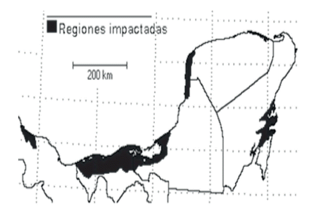
In this context of vulnerability the coast from Tabasco (Figure 1), host important natural resources such as the biosphere reserve Pantanos de Centla (RBPC), considered the most important unitofenergystorage in North America(Toledo, 2003) as well as areas for agricultural crops like pastures, cocoa, corn, family orchards and lake systems Carmen-Pajonal-Machona and Mecoacan; giving place to commercially important fish species, of which 90% of the state fishing (Contreras and Castañeda, 2004) is obtained. Associated to these coastal lagoons from Tabasco are mangrove species Rhizophora mangle (red mangrove), Avicennia germinans (black mangrove), Laguncularia racemosa (white mangrove) and Conocarpus erectus (Buttonwood mangrove) (Villanueva et al., 2010) conditioned to different salinity gradients and flooding periods.
According to tidal stations in the region, the tide is mixed with diurnal influence. The waves are moderate in E-W direction with maximum heights of 2m under normal conditions; however the winds from the north significantly increase wave heights up to 5 meters (SEMAR, s/f; Lankford, 1976).
Some studies performed in the coast of Tabasco show the vulnerability to INM (Hernandez et al., 2008; Ortiz et al., 2010), the main impact is coastal erosion, which in some places has been alarming (-3 to - 5 m / year in Sanchez Magallanes, Figure 2).

Vulnerability model: the inclusion of the term in the coastal context
For the IPCC (2007) vulnerability reflects the ability of a system or subsystem to cope with climate variability and extreme events. This conceptualization leads to expect an answer either positive or negative, to the extent in which are the coasts conditions (CEPAL, 2012). However, exposure, resistance and resilience are who determined in the physical context, the vulnerability of the coastal zone (Figure 3); therefore any vulnerability study, parts from the assessment of physical impacts on the environment (Klein and Nicholls, 1999).

According to the adopted model, the first three components indicate natural vulnerability (or relative); i.e. the impacts suffered in the physical environment. However, the ability to adapt, besides to complement the model, become the determinant factor of real vulnerability (or net) of the system. Therefore, many systems will have high natural vulnerability, but low socio-economic vulnerability (Ojeda et al., 2011) if it counts with the elements or efficient adaptation strategies. Therefore, the effects of INM can impact coastal resources, but these will be higher in regions with reduced capacity of adaptation (Bijlsma et al., 1996).
In Tabasco, the coastal area plays an important role in the economy of the entity, in particular in the municipalities of Cardenas, Paraiso and Centla, thus other nearby to the shoreline (Huimanguillo, Comalcalco and Jalpa de Méndez); the coastline stretches over 200 km, including an extensive network of runoff, deltaic plains, lagoon systems, marshes and swamps (Rodriguez-Rodriguez, 2002). The surface of this area is approximately of 80 000 hectares, representing 3.2% from the total surface of the entity; the potential use of the coastal area has been restricted to agricultural activities, specifically coconut, ranching, vegetable crops in small areas, and more recently to logging of mangrove (Palma-Lopez et al., 2007).
The effects of climate change can generate different levels of vulnerability, in the manner of how communities face them and the conditions of geographical space. According to De la Lanza et al. (1993), environmental changes and human intervention has led to a decrease in surface and changes in mangrove biodiversity in the lagoon area from Terminos, Campeche. In Tabasco the contrary situation is observed; the deltaic complex subsidence favors the advance of the coastline to the continent and the effects are seen through beaches and ports erosion, as well as the intrusion of sea water into the continent, contributing to expand flooded areas (Ortiz et al., 2005), condition that favors the growth of mangrove areas.
Evidence of the adaptation of some species to environmental changes, are modifications in the distribution patterns of these. According to Guerra and Ochoa (2006), although in 1992 the pantanos de Centla were declared as protected area, the variation by loss in the types of vegetation and land use has not stopped; only mangrove has been able to maintain the area occupied and even in other parts of the coast of Tabasco, such surface has increased.
The measurement model adopted: coastal vulnerability index
Accurately determine the response of the coast to INM is complex due to many variables that come into play. Coastal areas are non-lineal systems, where human activities, natural processes and policies regulations determine their ability to address and mitigate adverse events; however, these play an important role in INM (Pendleton et al., 2010).
The methodological framework from IVC prepared by Gornitz et al. (1992) and proposed to assess the vulnerability of the Atlantic coast of the United States of America (USA) considered indicators that influence in risks of flooding and coastal erosion, thus prioritizing the physical conditions of the coast in potential impacts by INM. This model was also applied to measure the sensitivity of Canadian waters (Shaw et al., 1998), in this case, by sensitivity understand, the magnitude of change in the coast produced by sea level rise. However, Thieler and Hammar (1999) adjusted Gornitz (1992) proposal to assess vulnerability in regional and national coastal parks from USA, considering six variables (Table 1). More recently, Ojeda et al. (2011) applied the model already fit, but made adjustments in one of the variables (replacing coastal slope for topographic index) according to the requirements of the Andalusian coast in Spain.
Table 1 Variables considered in each of the countries evaluated.

Incluye tipo de roca (litología); 1sustituida por índice topográfico2*variables descriptivas. a Gornitz et al. (1992), b Shaw et al. (1998), c Thieler y Hammar (1999) y d Ojeda et al. (2009).
This methodology uses a weighting system of 1(very low) to 5 (very high vulnerability), for each of the variables. The combination of six variables gives the degree of vulnerability of the coast (Ojeda et al., 2011) as follows:

Geological / geomorphological variables: coastal geomorphology, change rate of the coastline long-term and coastal slope.
Physical / hydrodynamic variables: change rate for relative sea level, average significant wave height and average tidal range. The six variables are integrated into an equation that gives as result the IVC and consequently different degrees of vulnerability along the coast; already applied in different countries (Table 1).
Index results allow anticipating the impacts that the coast will experience by INM. However, this model only indicates the relative vulnerability of each coastal stretch in terms of their exposure (physical environment) against INM. This represents the basis to perform studies with greater detail and allows estimating the risk and taking the necessary measures to safeguard the assets on the coasts.
Although there is plenty confidence that this model is applicable to any coastal environment (Gornitz, 1992; Thieler and Hammar, 1999), analyze each of the variables considered, since the model has been applied in large regions (Spanish Andalusian coast, Atlantic coast from US, Canadian coasts). This is argued because a more extensive coastline allows more diverse landscapes; however, in a "short" coastline like Tabasco (200 km) there are fewer environments, leading to reduce vulnerability classifications. On the other hand, coastal ocean processes influencing may be of greater or lesser intensity, which also affects vulnerability indicators. At the end the objective of this analysis is to ensure that the methodology is applicable to the coast of Tabasco and if not to include new variables or modify as necessary.
Methodology adopted and its relevance to the coast of Tabasco
The proposed methodology has been applied in the world to different coastal areas, therefore, to feed the model requires considering key aspects such as own characteristics of the coast under study, environmental pressures, its adaptability and available data (Figure 4).

Figure 4. Components to assess vulnerability by exposure on the coast of Tabasco. Based on Gornitz et al. (1992), Shaw et al. (1998), and Hammar Thieler (1999) and Ojeda et al. (2009).
Variables proposed vs local conditions
Low relief, the origin of its formation, the annual influence of cold fronts and excessive pressure from human activities, locate the coast of Tabasco in high vulnerability to INM. However, all natural systems have the capacity to withstand and recover from damage, which in ecology is known as resistance and resilience (Klein and Nicholls, 1999) these qualities limit the impact through adaptation to meet the sea level rise. The methodology proposes to confront the effects favored by marine phenomena such as waves, tides and sea level and qualities of the coast to mitigate those effects, such as the altitude above sea level and coast resistance, according its shape and geological origin.
1. Coastal geomorphology
This variable reflects coast resilience to erosion, therefore takes into account characteristics attributed to geological origin. Between coastal landforms it can be distinguished cliffs, long beaches, spits, deltas, swamps, glacial deposits, estuaries, coastal lagoons, offshore bars, among others (West et al., 1985).
In Tabasco ́s case, the combining of strong inflow of sediments and dense mangrove vegetation can mean long-term stability of a coast where the sea is growing at similar rates to global (Syvitski et al., 2005). Although geology / geomorphology variable in studies performed to date has considered mangroves as a type of coastal landform, the vulnerability degree assigned is moderate to very high vulnerability (Table 2). However, due to the lower diversity of landscape and little geologic differentiation of coastal environments of Tabasco, mangroves could have a lower degree of vulnerability (low to moderate).

2. Coastal slope
Tabasco is part of the Gulf of Mexico region, where lowlands and plains predominate, since the Tabasco coast extends into a low flood plain, this could be left out. However, there are minor differences in topography same that through a LIDAR digital model will allow to obtain measurements of great value to perform a relief differentiation along the coast.
3. Sea level rise
Trends in the Gulf of Mexico range from 1.8 ± 9.2 mm/year (Zavala et al., 2010). The danger becomes greater on the coast of Tabasco due to its geographical location and formation processes to which has been subject. However, the impacts cannot be uniform throughout the coast of Tabasco, as there are natural subsidence areas, other receiving sedimentary contributions, some with higher human pressure mainly by the extraction of hydrocarbons and the last protected with coastal infrastructure as geotubes, jetties and breakwaters.
4. Change in shoreline
It is considered that knowing the present and past of the coast is vital to detect risks by sea level rise on the coasts. In Tabasco, have been performed studies to evaluate this variable (Hernandez et al., 2008; Ortiz et al., 2010); data found show an alarming coastal retreat, in the delta from Rio San Pedro and San Pablo and in the area from Sanchez Magallanes, according to this the coast of Tabasco is showing signs of high vulnerability.
5. Swell
Swell is a phenomenon that contributes to the conditions of maritime climate, to know and predict their behavior is critical, since its occurrence modifies the coastline (Pérez et al., 2008).
The variable swell plays an important role in the vulnerability of the coast of Tabasco, on the understanding, which is of cumulative origin. The swell dynamics in Tabasco changes depending on weather conditions (storms, cold fronts and wind). West et al. (1985)) described waves ranging from 30 to 70 cm in calm weather; however, in the windy season the waves have more energy exceeding 5 m (Lankford, 1976; SEMAR s/f). This combination of relative calm and aggressive storm causes the migration of sediment, especially important for a cumulative cost of origin and serious threats to INM impacts, therefore it should be considered in impact assessments (Hernandez et al., 2008).
6. Tidal range
Normally coastlines are subject to tides. The coasts of Tabasco are microtidal; that is, the amplitude is small. Gornitz et al. (1994) found that a large tidal range dissipates wave energy, limiting active erosion to high tide periods but in turn can cause strong currents that can carry unconsolidated sediments. It should be noted that this variable is not relevant to the Tabasco coast, and at one point could be omitted or replaced by another.
Additional variables to the model
Sedimentation
Inland watersheds are responsible for the stability of coastal areas, produce, transports and deposit the inputs for coastal environments (Toledo, 2003). The annual contribution of the world's rivers is estimated between 20 billion metric tons of sediment that come under natural conditions (Milliman and Syvitski 1992). However, over 100 million tons of sediment being trapped in dikes and dams built in the last 50 years (Syvitski et al., 2005).
This is important, since the coast of Tabasco are the result of "powerful alluvial processes" (West et al., 1985), as has been the Grijalva-Usumacinta basin, the largest and mighty of Mexico. However, in the affluent from Grijalva by the construction of the largest dams systems in the country (Angostura, Chicoasén, Malpaso and Peñitas) and more recently at the bottom of the basin a control gate, and there is a relationship between changes of land use and the supply of sediment (Geyer et al., 2004).
Subsidence
The effects of human pressure on the coast contribute to higher levels of vulnerability. The settlement of major urban centers leads to overexploitation of aquifers, and construction in flood-prone areas. The coast of Tabasco is a plain with slopes lower than 10.5%; however, Grijalva- Usumacinta delta for natural conditions has a decreased subsidence resulting in higher beach erosion and shoreline retreat (Ortiz Linares, 1999). On the other hand it considers that the subsidence caused by the extraction of ground fluid (gas, oil and water) (Gornitz, 1994), favor a more extensive flooding area in the Tabasco coast.
Conclusions
The vulnerability model resulting from the review made in the different coastal scenarios, reveals that for better and more accurate vulnerability index from the effects of climate change on the Tabasco coast, it is necessary to taken into account for its study the six base variables, which are: coastal geomorphology, coastal slope, change in the coastline, sea level rise, swell and tidal range, considering that for Tabasco, the latter may or may not be essential; but adding two necessary variables such as sedimentation and subsidence.
For accurate results the correct application of the model of coastal vulnerability index is necessary. Due to the limited availability of data, continuous monitoring should be done, especially in places where there are serious threats of erosion like Sanchez Magallanes and the delta Grijalva-Usumacinta, the above will help to assess the potential future impacts.
The vulnerability of the Tabasco coast to sea level rise is evident; the application of this methodology with their respective adjustments will provide more accurate data on projected impacts and will be the basis to understand the changes on Tabasco coast and thus to plan strategies and make decisions in the medium and long term.
Literatura citada
Bijlsma, L.; Ehler, C. N.; Klein, R. J. T.; Kulshrestha, S. M.; McLean, R. F.; Mimura, N. and Warrick, R. A. 1996. Coastal zones and small islands. Climate Change 1995: impacts, adaptations, and mitigation of climate change: scientific-technical analyses. Contribution of working group II to the second assessment report of the IPCC. 289-324 pp. [ Links ]
CEPAL (Comisión Económica para América Latina y el Caribe). 2012. Efectos de cambio climático en las costas de América Latina y el Caribe: vulnerabilidad y exposición (consultado febrero, 2012). http://www.eclac.org/publicaciones/xml/0/46750/2011786w.460_vulnerabilidad_y_exposición_ web.pdf . [ Links ]
Contreras, F. E. y Castañeda, O. 2004. Las lagunas costeras y estuarios del Golfo de México: hacia el establecimiento de índices ecológicos. In: diagnóstico ambiental del Golfo de México. Caso, M.; Pisanty, I. y Ezcurra, E. (Comps.). Instituto Nacional de Ecología. México, D.F., 373-416 pp. [ Links ]
Finlayson, C. M.; Davis, J. A.; Kingsford, R. T. and Parton, K. A. 2013. The status of wetlands and the predicted effects of global climate change: the situation in Australia. Aquatic Sciences. 75(1):73-93. [ Links ]
Geyer, W. R.; Hill, P. S. and Kineke, G. C. 2004. The transport, transformation and dispersal of sediment by buoyent coastal flows. Continental Shelf Research. 24:927-949. [ Links ]
Gornitz, V.; White, T. W. and Cushman, R. M. 1992. Vulnerability of the U.S. to future sea level rise. conf-910780-i de 91 007853. [ Links ]
Gornitz, V. M.; Daniels, R. C.; White, T. W. and Birdwell, K. R. 1994. The development of a coastal risk assessment database: vulnerability to sea-level rise in the U.S. Southeast. Journal of Coastal Research. Coastal hazards: perception, susceptibility and mitigation. Special Issue No. 12. 327-338. [ Links ]
Guerra, M. V. y Ochoa, G. S. 2006. Evaluación espacio-temporal de la vegetación y uso del suelo en la Reserva de la Biosfera Pantanos de Centla, Tabasco (1990-2000). Investigaciones Geográficas, Boletin del Instituto de Geografía. Universidad Nacional Autónoma de México (UNAM). 59:7-25. [ Links ]
Hernández, J. R.; Ortiz, P. M. A.; Méndez, A. P. y Gama, C. L. M. 2008. Morfodinámica de la línea de costa del estado de Tabasco, México: tendencias desde la segunda mitad del siglo XX hasta el presente. Investigaciones Geográficas, Boletín del Instituto de Geografía. Universidad Nacional Autónoma de México (UNAM). 65:7-21. [ Links ]
INEGI (Instituto Nacional de Estadística y Geografía). 2010 (consultado diciembre, 2010). http://www3.inegi.org.mx/sistemas/mexicocifras/default.aspx?e=27 . [ Links ]
IPCC (Intergovernmental Panel on Climate Change). 2007. Climate Change 2007: impacts, adaptation and vulnerability. Contribution of working group ii to the fourth assessment report of the IPCC. Parry, M. L.; Canziani, O. F.; Palutikof, J. P.; van der Linden P. J. and Hanson, C. E. (Eds.). Cambridge University Press, Cambridge, UK. 976 p. [ Links ]
Junk, W. J.; An, S.; Finlayson, C. M.; Gopal, B.; Květ, J.; Mitchell, S. A.; Mitsch, W. J. and Roberts, R. D. 2013. Current state of knowledge regarding the world’s wetlands and their future under global climate change: a synthesis. Aquatic Sciences. 75(1):151-167. [ Links ]
Klein, R. J. T. and Nicholls, R. J. 1999. Assessment of coastal vulnerability to climate change. 2(28):182-187. [ Links ]
Lankford, R. R. 1976. Coastal lagoons of Mexico: their origin and classification. In: Wiley, M. (Ed.) Estuarine Processes. Academic Press. New York. (2):182-215. [ Links ]
Lara, J. R.; Arreola, J. A.; Calderón, L. E.; Camacho, V. F.; De la Lanza, G.; Escofet, A.; Ileana, M.; Guzmán, M. B. L.; López, M.; Meling, E. A.; Moreno, P.; Reyes, H.; Ríos, E. y Zertuche, J. A. 2008. Los ecosistemas costeros, insulares y epicontinentales. In: capital natural de México. Conocimiento actual de la biodiversidad. Comisión Nacional para el Conocimiento y Uso de la Biodiversidad (CONABIO). México, D. F., 1:109-134. [ Links ]
Mazda, Y.; Magi, M.; Kogo, M. and Hong, N. 1997. Mangroves as a coastal protection from waves in the Tong King delta, Vietnam. Mangroves and salt marshes. 1:127-135. [ Links ]
Milliman, J. D. and Syvitski, J. P. M. 1992. Geomorphic/tectonic control of sediment discharge to the ocean: the importance of small mountainous rivers. J. Geology. 100:525-544. [ Links ]
Nicholls, R. 2002. Analysis of global impacts of sea-level rise: a case study of flooding. Physics and Chemistry of the Earth. 27:1455-1466. [ Links ]
Ojeda, J.; Álvarez, J. I.; Cajaraville, D. M.; Fraile, P.; Vallejo, I. y Márquez, J. 2011. Análisis preliminar de la vulnerabilidad de la costa de Andalucía a la potencial subida del nivel del mar asociado al Cambio Climatico. Consejería de Medio Ambiente. Junta de Andalucía. Unión Europea. Fondo Europeo de Desarrollo Regional. 154 p. [ Links ]
ONU/EIRD (Naciones Unidas- Estrategia Internacional para la Reducción de los Desastres). 2008. El cambio climático y la reducción del riesgo de desastres. Ginebra (consultado mayo, 2008). http://eird.org/publicaciones/rrd-cambio-climatico.pdf . Nota informativa Núm. 1. [ Links ]
Ortiz, P. M. A. y Linares, A. P. 1999. Escenarios por ascenso del nivel del mar en la costa mexicana del Golfo y el Mar Caribe. Investigaciones Geográficas, Boletin del Instituto de Geografía. Universidad Nacional Autónoma de México (UNAM). 39:68-81. [ Links ]
Ortiz, P. M. A.; Hernández, J. R.; Figueroa, M. E. J. M. y Gama, C. L M. 2010. Tasas del avance transgresivo y regresivo en el frente deltaico tabasqueño: en el periodo comprendido del año 1995 al 2008. In: vulnerabilidad de las zonas costeras mexicanas ante el Cambio Climático. Botello, A. V.; Villanueva-Fragoso, S.; Gutiérrez, J. y Rojas-Galaviz, J. L. (Eds.). SEMARNAT- INE, UNAM-ICMyL, Universidad Autónoma de Campeche. 305-324 pp. [ Links ]
Palma-López, D. J.; Cisneros, D. F.; Moreno, C. E. y Rincón, R. J. A. 2007. Suelos de Tabasco: su uso y manejo sustentable. Villahermosa, Tabasco, México. Colegio de Postgraduados en Ciencias Agrícolas. ISPROTAB-FUPROTAB. 195 p. [ Links ]
Pendleton, E. A.; Thieler, E. R. and Williams, S. J. 2010. Importance of coastal change variables in determining vulnerability to sea- and lake-level change. Journal of Coastal Research. 261:176-183. [ Links ]
Pérez, D. M.; Bolaños, R. y Silva, R. 2008. Predicción del oleaje generado por dos huracanes en las costas del Golfo de México. Ingeniería Hidráulica en México. 2(23)5-20. [ Links ]
Reyes, E.; Day, J. W.; Lara, A. L.; Sánchez, P.; Zarate, D. and Yañez, A. 2004. Assesing coastal management plans using wathershed spatial model for the Mississippi delta, USA, and the Usumacinta-Grijalva delta, México. Ocean & Coastal Management. 47:693-708. [ Links ]
Rodríguez-Rodríguez, E. 2002. Las lagunas continentales de Tabasco. Universidad Juárez Autónoma de Tabasco. México. 264 p. [ Links ]
SEMAR (Secretaría de Marina) s/f (consultado junio, 2010). http:// digaohm.semar.gob.mx/cuestionarios/cnarioFrontera.pdf . [ Links ]
SEMARNAP (Secretaría de Medio Ambiente y Recursos Naturales). 1997. Primera comunicación nacional ante la convención marco de las Naciones Unidas. Secretaría del Medio Ambiente y Recursos Naturales y Pesca. 139 p. [ Links ]
Shaw, J.; Taylor, R. B.; Forbes, D. L.; Ruz, M. H. and Solomon, S. 1998. Sensitivity of the Canadian coast to sea-level rise. Geological Survey of Canada. 505:1-90. [ Links ]
Sheik, M. P. and Chandrasekar, N. 2011. Coastal erosion hazard and vulnerability assessment for southern coastal Tamil Nadu of India by using remote sensing and GIS. Natural Hazards. 1-11. [ Links ]
Syvitski, J.P.M.; Vörösmarty, C.J.; Kether, A.J. and Green, P. 2005. Impact of human son the flux of terrestrial sediment to the global coastal ocean. Science 308:376-380 DOI: 10.1126/science.1109454. [ Links ]
Thieler, R. and Hammar, E. 1999. National assessment of coastal vulnerability to sea-level rise: preliminary results for the U.S. Atlantic Coast. U.S. Geological survey. Woods hole, Massachusetts. Open-file report. 99-593. [ Links ]
Toledo, A. 2003. Ríos, costas y mares. Hacia un análisis integrado de las regiones hidrológicas de México. INE-SEMARNAT. 117p. [ Links ]
Tunnell, J. W. Jr.; Felder, D. L. y Earle, S. A. 2004. El Golfo de México: pasado, presente y futuro. Una colaboración entre Estados Unidos de América, México, Cuba. In: diagnóstico ambiental del Golfo de México. Caso, M.; Pisanty, I. y Ezcurra, E. (Comps). Instituto Nacional de Ecología, México, D.F., 361- 371 pp. [ Links ]
Turner, R. K.; Subak, S. and Adger, W. N. 1996. Pressures, trends, and impacts in coastal zones: interactions between socioeconomic and natural systems. Environmental Management. 20(2):159- 173. [ Links ]
Vafeidis, A.; Nicholls, R. J.; McFadden, L.; Tol, R.; Hinkel, J.; Spencer, T.; Grashoff, P. S.; Boot, G. and Klein, R. 2008. A new global coastal database for impact and vulnerability analysis to sea- level rise. Journal of Coastal Research. 4(24):917-924. [ Links ]
Villanueva, S.; Ponce, G.; García, C. y Presa, J. 2010. Vulnerabilidad de la zona costera. Ecosistemas costeros. In: vulnerabilidad de las zonas costeras mexicanas ante el Cambio Climático. Botello, A. V.; Villanueva-Fragoso, S.; Gutiérrez, J. y Rojas-Galaviz, J. L. (Eds.). SEMARNAT-INE, UNAM-ICMyL, Universidad Autónoma de Campeche. 37-72 pp. [ Links ]
West, R.; Psuty, N. P. y Thom, B. 1985. Las tierras bajas de Tabasco en el sureste de México. Villahermosa, Tabasco. Instituto de Cultura de Tabasco. 416 p. [ Links ]
Zavala, H. J.; De Buen, R.; Romero, R. y Hernández, F. 2010. Tendencias del nivel del mar en las costas mexicanas. In: vulnerabilidad de las zonas costeras mexicanas ante el Cambio Climático. Botello, A.V.; Villanueva-Fragoso, S.; Gutiérrez, J. y Rojas-Galaviz, J. L. (Eds.). SEMARNAT-INE, UNAM-ICMyL, Universidad Autónoma de Campeche. 249-368 pp. [ Links ]
Received: November 2015; Accepted: February 2016
 Este es un artículo publicado en acceso abierto bajo una licencia Creative Commons
