


Servicios Personalizados
Revista

Articulo
 Inglés (pdf)
 Artículo en XML
 Referencias del artículo
 Enviar artículo por email
Indicadores
 Citado por SciELO
 Links relacionados
-
 Similares en
SciELO
Similares en
SciELO
Compartir

 Permalink
Revista mexicana de ciencias geológicas
versión On-line ISSN 2007-2902versión impresa ISSN 1026-8774
Rev. mex. cienc. geol vol.24 no.3 Ciudad de México dic. 2007
Sección especial
Pedogenesis and slope processes in subtropical mountain areas, Sierra Sur de Oaxaca, Mexico
Pedogénesis y procesos de ladera en áreas subtropicales montañosas, Sierra Sur de Oaxaca, México
Pavel Krasilnikov1,2, Norma Eugenia García–Calderón1*, and Elizabeth Fuentes–Romero1
1 Laboratorio de Edafología Nicolás Aguilera, Facultad de Ciencias, Universidad Nacional Autónoma de México, Ciudad Universitaria, Circuito Exterior s/n, 04510 México D.F., México. * andosol@yahoo.com
2 Institute of Biology, Karelian Research Center, Russian Academy of Sciences, Pushkinskaya str., 11, 185610, Petrozavodsk, Russia.
Manuscript received: October: 11, 2005
Corrected manuscript received: March 3, 2007
Manuscript accepted: March 6, 2007
ABSTRACT
The study was conducted in a subtropical mountainous area of the Sierra Sur de Oaxaca, southern Mexico. This region has been reported to have a high diversity of soils due to erosion and deposition by slope processes triggered by seismic activity and rainstorms. In this study, lithologic properties indicate that 18 of 24 soil profiles received sediments as result of slope processes (landslides, colluviation, accumulation of the material washed out by sheet and inter–rill erosion). The profiles showing sediment deposition on the surface were formed on all landforms, except steep backslopes, where the loss of material is more intensive. The effect of newly accumulated sediment was previously underestimated, and varies from slight modification of soil properties to complete burial of a soil that forces pedogenesis to begin from "time zero". Sediment accumulation due to slope processes should be included into a general pedogenic model for the study area.
Key words: tropical mountain soils, lithological discontinuity, landslides, erosion.
RESUMEN
El estudio se realizó en un área subtropical de montaña en la Sierra Sur de Oaxaca en el sur de México. En la región se ha reportado una gran diversidad de suelos, lo que se atribuye a procesos activos de ladera, inducidos por sismos y lluvias fuertes. El estudio de las propiedades del suelo mostró que la mayoría de los perfiles (18 de 24) han recibido sedimentos por procesos de ladera (dislizamientos, coluviación y acumulación de material transportado por erosión laminar y de cárcavas). Los perfiles con evidencias de deposición de material se encuentran en todas las geoformas excepto en laderas rectas muy inclinadas, donde la pérdida de material es más intensa. El efecto de la acumulación de sedimentos en suelos ha sido subestimada en estudios anteriores; produce desde una ligera modificación de las propiedades de los suelos hasta la sepultura del antiguo suelo y el inicio de la pedogénesis a partir del "momento cero". La acumulación de material en el suelo por efecto de los procesos de ladera debe considerarse en el modelo general de pedogénesis en el área de estudio.
Palabras clave: suelos tropicales de montaña, discontinuidad litológica, deslizamientos, erosión.
INTRODUCTION
Several publications have emphasized the role of slope processes in the development of soils of mountain areas (Gerrard, 1992; Birkeland, 1999). A general model that has been proposed to explain soil formation on steep slopes includes: Rock exposure due to erosion and incipient soil formation on the outcrops (Graham et al., 1988), along with accumulation of eroded sediments in footslopes and consequent soil formation in these accumulated sediments (Graham and Buol, 1990; Graham et al., 1990). In tropical mountain areas, the rate of erosion and sedimentation processes is even greater than in temperate regions, and these processes determine to a great extent the formation of both landforms and soils in tropical mountains (Rohdenburg, 1983). However, the presence of relatively thick soil profiles has been detected on steep slopes in tropical areas (Drees et al., 2003). All studies stress the complexity of the soil mosaic in mountain areas, especially in the tropics, where both slope and pedogenic processes are rapid.
Recently, we proposed a model to explain soil diversity in the tropical Sierra Sur de Oaxaca of southern Mexico (García–Calderón et al., 2006). According to the model, landslides of various ages and magnitudes expose rock and sediment, and soil formation begins on these exposed surfaces. It is well known that in clayey sediments, including deep clayey soils, landslides are often triggered by heavy rainfall (Dykes, 2002) or earthquakes (Cetin et al., 2004; Chang et al., 2005). Both phenomena are frequent in the study area (Rojas–Rabiela et al., 1987; García–Calderón et al., 2000). If we relate landslides to certain events such as earthquakes and hurricanes with heavy rainfall, then the exposed surfaces should have different distinct ages, and the soils formed on these surfaces can be arranged in a chronosequence according to their degree of development. For temperate mountain regions, this method was first described by Terhorst (1999) and Bibus et al. (2001). The study of such a chronosequence can help us to better understand trends and rates of soil development in tropical mountain areas (Huggett, 1998).
However, our previously proposed model is insufficient to explain the complexity of the soils in the Sierra Sur de Oaxaca. Our recent studies confirmed a significant influence of gully erosion on the mosaic of soils in the region (Krasilnikov and García–Calderón, 2005). Additionally, other slope processes such as sheet erosion can contribute to the formation of the complexity of soils in the area. These considerations bring uncertainty to a modeled chronosequence of soils based only on the landslide hypothesis. Erosional processes act continuously and cannot be related to a single event; although it has been shown that gully erosion often results from rainstorms (Billi and Dramis, 2003), further development of gullies is a relatively long process. Moreover, the model disregarded the accumulation of eroded material on the soil surface, which can completely change the course of soil formation by burying the pre–existent soil. Butler (1982) called the erosion and burial of a soil surface a "K–cycle." The K–cycle model implies alternating periods of slope instability, when erosional–depositional processes occur, and periods of relative slope stability when "normal" top–down pedogenesis takes place in the newly deposited sediment. Instability periods keep the soils relatively underdeveloped in the upper part of the slope, while in the lower part of the slope complex soil profiles with buried soils develop, resembling pedocomplexes (Smolnikova, 1967) or "welded soils" (Ruhe and Olson, 1980). Previously, Krasilnikov et al. (2005) established that both eroded and buried soils, as well as soils showing evidence of a K–cycle are present in the Sierra Madre del Sur. This evidence is the reason why an additional model of soil formation for the area that includes erosion and accumulation processes is needed to better understand the trends and rates of soil development. In this paper we group some profiles in the study area in terms of the loss/accumulation of material and to include this information in a general model of soil development.
MATERIALS AND METHODS
Study area
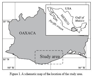
The research was conducted in the subtropical belt of the Pacific slope of the Sierra Sur de Oaxaca mountain system (Figure 1) at the altitudes varying from 700 to 1,300 m above sea level. The system was formed by tectonic uplift during the Miocene (Morán–Zenteno et al., 1996); minor uplift also occurred in the Pliocene and even in the Quaternary (Centeno–García, 2004). The rocks are mainly Paleozoic gneiss and amphibolite and Cenozoic granitites (Hernández–Santana et al., 1996). The climate of the Sierra Sur de Oaxaca is strongly affected by the orientation of the escarpment. The northern slope (oriented to the continental part) receives little precipitation, and the climate is classified as semi–arid. The southern and south–western slopes are exposed to humid air coming from the Pacific Ocean, and the climate is classified as warm humid isothermal with annual precipitation of 1,800 to 2,000 mm and a mean annual temperature of 21 to 21.9 °C (García, 1973). Climatic parameters vary depending on the slope aspect and altitude, but exact data for the study area are not available because few meteorological stations exist in the region. The region has two main seasons: dry from December through May and wet from June through November. Vegetation in the area consists of coffee plantations (Coffea arabica var. typica L.) under the canopy of residual natural vegetation: Bosque tropical subcaducifolio, Tropical Semideciduous Forest (Rzedowsky, 1978). The most abundant natural plant species of the zone are: Brosimum alicastrum, Enterolobium cyclocarpus, Pterocarpus acapulcensis, Bursera simaruba, Caesalpinia coriacea, Ceiba pentandra, Cordia aliodora, and Ficus spp. (Lorence and García, 1989; Flores and Manzanero, 1999). Coffee growing under the shade of natural vegetation is a common agroforestry practice in the study area; the quality of coffee grown under canopy is believed to be high, and the natural ecosystem is conserved due to relatively dense tree vegetation (Staver, 1998). Only regional soil studies exist in the zone (Alfaro–Sánchez, 2004); the few available investigations (e.g., García–Calderón et al., 2000) report Acrisols, Luvisols, and Cambisols (FAO–ISRIC–ISSS, 1998) as the main soil groups. Some recent studies demonstrated that the soil pattern in the Sierra Madre del Sur is complex. Most of the soils are affected by slope processes such as erosion and mass movement (Fuentes et al., 2002; García–Calderón et al., 2005; Krasilnikov and García–Calderón, 2005; Krasilnikov et al., 2005).
In total 24 soil profiles were studied in the area. The profiles La Presa, El Ranchito, El Mirador, La Primavera, El Espinazo and El Portillo were described at the coffee–growing farm El Sinaí (16°07'41.5" N and 97°06'12.9" W) located in the municipality of Santos Reyes Nopala (see Figures 1 and 2); a detailed description of the site and soils is reported in García–Calderón et al. (2005). The profiles San Juan Lachao and La Unión were made at the farm Armenia, situated at the border with the farm El Sinaí. The profiles La Cañería 1, 2 and 3, and Palo Piedra 1, 2 and 3 were made at the coffee–growing farm La Cabaña (15°54'48" N and 96°23'19" W) in the municipality of Pluma Hidalgo (Figure 3); detailed site and soil characteristics were published recently (Krasilnikov et al., 2005). The profiles El Nueve 1, 2 and 3 were made at the coffee–growing farm El Nueve (15°55'52" N and 96°17'04" W) in the municipality of Sta. María Huatulco (Figure 4); the soils and environments of the site are partially presented in a paper by Krasilnikov and García–Calderón (2005). The profiles Corrida San Joaquín and Corrida Los Pocitos were made at the farm Vista Hermosa, the profiles La Curva and Metate at the farm San Juanito, the profiles Cuapinol and El Diez at the farm San Francisco, and one profile at Rancho San Diego; all are located in the municipality of Pluma Hidalgo.


Methods
Morphological description was done according to Schoeneberger et al. (2002); colours were identified using Munsell Soil Color Charts (Munsell Color, 2000); field observations were supported by mesomorphological studies using a stereoscopic microscope. Soils were classified according to the World Reference Base (FAO–ISRIC–ISSS, 1998). Samples for chemical analysis were collected from soil horizons and analysed according to the routine methods of soil chemical and physical analysis (van Reeuwijk, 2002). Texture was determined using the pipette method, and organic C by wet combustion. Bulk chemical composition was determined using standard chemical methods, as described in Page et al. (1982). The clay fraction was separated and pre–treated using the method of Dixon and White (1999). X–ray difractograms were obtained on a diffractometer DRON–3 (Scientific Industrial Enterprise"Burevestnik", St. Petersburg, Russia) using Cu–Kα radiation with a graphite monochromer and scanned from 2 to 45° 2θ, with U = 40 kV, I = 25 mA.
The following criteria were used to identify lithologic discontinuities: 1) the presence of "stone lines" and/or discontinuities in rock fragment content or composition; 2) abrupt textural change between soil horizons in sand content on a clay–free basis; 3) unusual distribution of clay minerals along the vertical sequence of soil horizons ("unusual" in that case means that the general sequence from less to more weathered minerals towards day surface is not followed, and the phenomenon is not readily explained by pedogenic processes); 4) non–uniformity of bulk chemical composition of soil, which can not be attributed to soil weathering (e.g., the loss of Ca and Mg and Si residual accumulation in the topsoil might be explained by pedogenic leaching, while much larger percentages of Na and Mg in the topsoil more probably indicates a lithologic discontinuity; the most informative parameters were molar ratios of elements); 5) irregular distribution of organic C in the profile (gradual decrease in C content was expected in undisturbed soils); 6) unusual soil colour distribution ("unusual" in that case means that contrasting colours – change in hue 2.5 points, or change in chroma or value 2 or more points – were observed between soil horizons, which could not be explained by pedogenic processes).
RESULTS
Soil classification
We classified 24 profiles situated in the area according to the World Reference Base (FAO–ISRIC–ISSS, 1998). The soils belong to the following reference groups: Luvisols (7 profiles), Cambisols (7 profiles), Phaeozems (4 profiles), Umbrisols (3 profiles), Acrisols (1 profile), Leptosols (1 profile) and Ferralsols (1 profile). The latter soil profile is still under discussion; the difficulties with its classification were discussed in detail in our previous publication (García–Calderón et al., 2005). According to our field observations, the relative abundance of soil reference groups in the set of the studied profiles roughly reflects their real abundance in the study area.
Evidence of lithologic discontinuities
We searched for evidence of lithologic discontinuities, such as irregularities of vertical distribution of organic C content, stoniness and the presence of stone lines, sand percentage on clay–free basis, and unusual changes in colour. The results are presented in Table 1.
The profile La Presa has contrasting colours (hue) and an abrupt textural change (though sand content is relatively uniform). The difference in moist colour between the AB and Bt horizons is too great relative to our observations of normal pedogenic trends: 10YR2/2 vs. 2.5YR4/6. Though the value and chroma of the AB horizon depend mostly on organic C content, the red–coloured matrix should contribute to its hue, and we would expect much redder colour there if the mineral soil material is the same in the topsoil and in the B horizons. The textural change is also too large for a uniform soil: clay content is 19.6 % higher in the Bt horizon than in the AB horizon (almost triple). Though theoretically such a large difference might be caused by pedogenesis, no one of the profiles in the study area has such a contrasting clay distribution.
The profile El Ranchito has an irregular distribution of organic C content in the topsoil and sand content in the B horizons. The A1 horizon has less organic C, than the A2 and consequently, slightly lighter colour. The sequence is unusual for the soils of the area and can be ascribed to a lithologic discontinuity. Sand content on a clay–free basis in the AB, Bt1 and Bt2 horizons is irregular (60.2, 48.1, and 65.2 %, respectively), and cannot be explained by pedogenic processes.
Rock fragments are present in the topsoil of the profile El Espinazo, while absent in the subsoil. Rock fragments confirm the presence of colluvial material in the topsoil, because in an undisturbed profile, the content of rock fragments should be uniform or increase with depth. The profile El Portillo has a stone line in the BC horizon. The presence of stone lines is nearly always regarded as evidence of non–uniformity and of a lithologic discontinuity (Birkeland, 1999).
In the profile El Nueve 2, the distribution of sand, calculated on a clay–free basis, is irregular: the difference in sand content between the horizons A and Bo is almost 10 %, and between the Bo and Bw horizons is more than 14 %. Such a difference is improbable for soils formed in uniform material. Also there is a minor increase in organic C content in the BC horizon, while all the other profiles have a regular decrease in C content with depth.
The organic C content in the A1 horizon in the profile La Cañería 1 is less than in the A2. Also sand content on a clay–free basis is more than twice higher in the A1 than in the A2.
We observed in the profile La Cañería 2 irregular stoniness distribution: rock fragment content is much higher in the upper two horizons than in the 2Btb horizon, and most of the rock fragments are concentrated at the boundary between the EB and 2Btb horizons. The same phenomenon was observed in the profile La Cañería, where the sand percentage on a clay–free basis decreases more than 10 % at the boundary between the C and 2EBb horizons.
The profile Palo Piedra 1 has a buried soil, which is evident morphologically by the presence of a darker buried 2Ab horizon. The laboratory data confirm the presence of a buried soil with irregular organic C content and stoniness distribution. In the profiles Palo Piedra 2 and 3 there is an irregular sand content distribution. Also, in the profile Palo Piedra 3, the largest content of rock fragments is in the transitional EB horizon.
Irregular rock fragment distribution was also observed in the profile Corrida Los Pocitos: the stoniness is large in the topsoil, while from 50–77 cm there are no stones, and then below 77 cm there are 10–30 % of rock fragments. The discontinuity of sediments in this profile is confirmed by the distribution of clay–free sand content: at 50–77 cm sand content is 20 % less than in the overlying horizon. The profiles La Curva and Rancho San Diego have contrasting changes in colour (hue) and irregular rock fragment and sand content distribution. In both profiles, the topsoil has hue 10YR, while the underlying horizons have redder colours.
The profiles El Metate, Cuapinol and El Diez have an irregular distribution of rock fragments and sand content. The former profile has three distinct stone lines, indicating former soil surfaces. In the latter two profiles, the content of rock fragments is higher in the upper horizons than in the lower ones. The profile San Juan Lachao has an irregular clay–free sand distribution, with 10 % less sand in the AB horizon than in the overlying A2 horizon.
Tables 2 and 3 present additional information confirming the non–uniformity of the sediments in some of the studied profiles. There is an unusual sequence of clay minerals as the presence of weatherable 2:1 and/or 2:2 minerals in the topsoil, while in deeper horizons mostly kaolinite and gibbsite occur. This data indicates younger sedimentation on the soil surface of profiles La Presa, La Cañería 1 and 2, and Palo Piedra 2 (Table 2). The presence of halloysite in the A horizon (0–55 cm) of the profile El Nueve 2 might indicate weathering there (Dixon and White, 1999), which means that there is a source of fresh mineral material in the topsoil of this strongly weathered soil. The distribution of clay minerals in the profiles La Primavera, El Portillo, and La Cañería 3 is irregular. For example, in the profile La Primavera the content of gibbsite is highest in the C1 horizon (semiquantitative evaluation); also in this horizon there is mixed–layered chlorite–vermiculite, which is absent in other horizons. Also in the same profile, the contents of illite and illite–vermiculite are the highest in the A2 and C1 horizons. In the profile El Portillo the content of halloysite is higher in the upper (A) and the deepest (C) horizon. Also, in the BC horizon there is vermiculite, a mineral that is absent in other horizons. In the profile La Cañería 3 the distribution of clay minerals is highly irregular: illite is present in the A (0–20 cm), BC (30–40 cm), and 2Btb horizons (85–165 cm), illite–vermiculite in the BC (30–40 cm), C (40–65 cm), and 2EBb (65–85 cm) horizons, and chlorite only in the Bw horizon (20–30 cm). Pedogenic processes do not explain such irregular distribution of clay minerals in soil profiles.
The bulk chemical composition of fine earth of some soils and the molar ratios (Al2O3+Fe2O3)/SiO2, (Al2O3+Fe2O3)/TiO2, MgO/CaO, and (CaO+MgO)/TiO2 (Table 3) indicate that there are irregularities in soil mineral composition in some profiles. In the profile La Cañería 1, the (R2O3)/TiO2 ratio is much smaller in the A1, than in the A2 horizon. The ratio MgO/CaO varies in a very broad range in the profile La Cañería 2; a very small MgO/CaO value in the A horizon might be ascribed to the biological accumulation of Ca in the topsoil, but the difference between the EB and 2Btb horizons is most probably the result of a lithologic discontinuity. The distribution of molar ratios of elements is completely irregular in the profile La Cañería 3: the R2O3/SiO2 ratio ranges from 0.39 to 0.86, R2O3/TiO2 ranges from 24.0 to 136.0, MgO/CaO from 1.0 to 13.0, and (CaO+MgO)/TiO2 from 0.7 to 3.5. In the profile Palo Piedra 1, (R2O3)/TiO2 and (CaO+MgO)/TiO2 ratios indicate a distinct difference between the upper two, and the deeper horizons. In the profile Palo Piedra 2, the same ratios indicate that the Cr horizon has a different origin, than the overlying horizons.
The soil–landform relation
The studied soils are found on different geoforms (Table 1; Figures 2, 3 and 4). A review of the profiles with evidence of a lithologic discontinuity shows that three of the soils were formed on convex slopes, seven on concave slopes, three on backslopes (mainly with moderate inclination), two on footslopes, and one profile at each geoform: summit, convex shoulder, and footslope/shoulder of the slope. Among the profiles without evidence of a lithologic discontinuity, four occured on backslopes (mainly steep ones) and two at concave shoulders of the slopes.
DISCUSSION
The extent of sediment accumulation on slopes
The different criteria applied to detect lithologic discontinuities were generally consistent between methods. Several profiles showed morphological, chemical, physical, and mineralogical evidence of a parent material lithologic discontinuity, while the others were consistent only among some lines of evidence. Among the 24 studied profiles, 18 have evidence of sediment accumulation. It is important to note that the profiles were selected at random, in the sense that we did not search for profiles with evidence of sediment accumulation. Thus, we believe the percentage of soils with lithologic discontinuity (75 %) roughly reflects the extent of such soils in the area, although we acknowledge that from a spatial statistics perspective our sample size may not be statistically robust enough to be valid.
Soils, landforms and types of slope processes
Steep backslopes seem to be affected mainly by erosional processes and we found no evidence of sediment accumulation there. The peculiarity of the study area is that apparently eroded soils (i.e., lacking organic matter enriched topsoil) are seldom found on backslopes. The soils on steep backslopes have A horizons that are 30–50 cm thick, which may be interpreted in terms of slower sheet erosion than A horizon formation. Biological productivity of the ecosystem is high, and humus formation should be a rather rapid process. However, the comparative study of the reserves of organic C along a typical catena (Krasilnikov et al., 2004, see also Figure 5) confirmed relative loss of organic matter from backslope and shoulder positions, which was ascribed to sheet erosion. The balance was calculated as a difference between the medium value of organic C reserves and its values in every profile. Positive values were regarded as an evidence of organic C accumulation, and negative ones as an evidence of C loss. On the upper convex part of a shoulder there is a minor increase in organic carbon reserves. The phenomenon indicates a complex character of soil material redistribution by slope processes. To understand soil formation on different landforms we should explain the mechanisms of sediment accumulation at each landform position.

The accumulation of sediments at toeslope and footslope positions is usually ascribed both to colluviation and deposition of the material that was removed and transported by sheet erosion at higher elevations. The concave slopes (concave along horizontal contour, across slope) at these sites are mainly wide runoff channels. These landforms are eroded surfaces, often denudated down to the bedrock, but we also observed accumulation of organic matter enriched A horizons there, in places half meter or deeper. Our field observations correspond to the data obtained by other authors. The widening of runoff channels by lateral erosion is rather widespread in tropical mountains even on steep slopes (Rohdenburg, 1983); while a concave longitudinal profile develops and the channel widens, erosional processes decrease their intensity and accumulation of sediment might occur. Rohdenburg (1983) indicates that the situation can be indicated by the presence of coarse materials (i.e., a stone line) under subsequently deposited fine sediments.
Unusual accumulation of fresh sediments on convex slopes was explained by a landslide hypothesis (Krasilnikov et al., 2005). When a landslide occurs, the sliding mass of material forms a convex slope. Fresh sediment, exposed at the landslide scar, is transported by gravity and sheet erosion, and in places overlies clayey material transported by the landslide. Sediment accumulation on moderate sloping backslopes was also detected. We believe that vegetation might play a major role in stabilizing colluvium (like in the profile El Espinazo, see Table 1), or that fine earth was deposited from higher landscape positions (like in the profile El Nueve 2, see Tables 1 and 2).
Thus, the following correspondence may be tentatively established. On toeslopes and footslopes we expect an accumulation of a mixture of coarse colluvium and fine earth, eroded from upper positions. On backslopes and concave slopes there should be accumulation of fine earth of varying texture washed out from upper sites by sheet erosion. Convex slopes should include relatively undisturbed landslide bodies covered with colluvium and/or finer sediments transported by inter–rill erosion.
The processes of sedimentation observed at the study area are caused by different natural phenomena. Inter–rill erosion is a natural phenomenon in all humid steep land forest ecosystems. Low–magnitude/high–frequency rainfall events are believed to cause mainly gully erosion (Glade, 2003), while major rainstorms cause landslides (Dykes, 2002; Glade, 2003). Landslides are also often triggered by earthquakes (Cetin et al., 2004; Chang et al., 2005), which have been reported to be frequent in the study area (Rojas–Rabiela et al., 1987). However, gully erosion in the study area can also be caused by extreme climatic events: local people reported that some gullies were formed in a day or two during heavy rainfalls associated with hurricane Rick in 1998.
The typical hillslope processes for the study area, the natural phenomena that cause them, the related landforms, and evidence of these processes in soil profiles are summarised in Table 4. Most of the profiles formed in complex assemblages of sediments that were deposited by runoff water and gravity in relation to high–frequency normal rainfalls. Also, earthquake–triggered landslides are responsible for the complex nature of the parent material of several soils. Unfortunately, no data are available on the incipient soils formed in sediments that accumulated as result of low–frequency rainstorms. We recorded such profiles during our field research, but we did not studied them in detail. More studies are needed to understand completely the role of geomorphologic processes on pedogenesis in the region.
Integrating slope processes into pedogenetic model
In our previous paper (García–Calderón et al., 2006), we proposed a general model of pedogenesis in the mountainous areas of Sierra Sur de Oaxaca. According to this model, the whole study area is a mosaic of surfaces exposed by slope processes of various ages. After a surface is exposed, the soils develop with time from Regosols (weakly developed soils) to Cambisols (more developed soils with A horizon), then to Umbrisols (soils with a well–developed A horizon with a base saturation of less than 50 %), and finally to Luvisols and Alisols (soils having argic horizon). The model included also the possibility of accumulation of fresh sediment on the soil surface. Sediment accumulation is considered a positive process, because colluvial material is a source of weatherable minerals, and thus nutrients; it is well known that erosion and/or accumulation of sediments in tropical areas, where highly weathered, nutrient–poor soils are widespread increases soil productivity (Fyfe et al., 1983). However, in our earlier model we ignored the fact that slope processes might remove either the whole soil body or just the surface soil horizons, thus exposing already pedogenically altered material to a new cycle of soil formation. Also the importance of new material accumulation was underestimated.
The effects of sediment accumulation range widely depending on the amount of deposited material: from a minor increase in topsoil depth to complete burial of pre–existing soils/sediments by newly accumulated materials. When minor amounts are accumulated on the soil surface, they are fairly rapidly integrated into the soil body by pedogenesis, and in the case of complete burial, soil formation practically starts from "time–zero" in the newly formed sediments (Targulian and Goryachkin, 2004). The effect of new material deposition on the soil surface also depends to a great extent on the existing soil material that is receiving sediment, and on the origin of the transported material. One of the common situations is fresh unweathered sediment deposition over a clayey soil. The most evident examples are the profiles La Presa and La Cañería 2 and 3 (Krasilnikov et al., 2005; García–Calderón et al., 2005). In these profiles, the presence of fresh sediment on the surface favours higher cation exchange capacity and base saturation of the topsoil. However, unweathered sediment deposition is not the only possible model of soil development. Many profiles are formed on surfaces previously exposed by landslides or erosion, and their composition does not differ much from the material they receive on the surface. Also, there are some particular cases, like profile El Nueve 2 that we previously classified as a Ferralsol (García–Calderón et al., 2005), but noted a contradiction between the mineralogical composition of low–activity clays and the sand fraction that is relatively rich in weatherable minerals. When a lithologic discontinuity is apparent, we propose that the first meter of the soil was deposited by surface runoff and is composed of clays that come from red weathered clayey soils, while the sand fraction of coarser material was washed out from outcrops of sandy saprolite.
A combination of factors leads to a great diversity of soils forming in the landscapes in the study area; each hillslope process leads to the formation of not a single specific soil unit, but to a wide range of soils of various stages of development (Table 4).
Relative and absolute age of soils
Estimating soil age in dynamic geomorphic environments is always difficult. Even landslides, which can be regarded as single events, are not easy to date. Most studies of pedogenesis rates on landslides deal with recent events, having historical records (Zarin and Johnson, 1995; Sparling et al., 2003; Wilcke et al., 2003), so that the age of the soils is not more than a few decades, and the authors concentrate on relatively rapid pedogenic processes such as organic C and nutrient accumulation. There are studies on ancient mass movements, but at much greater, geological time scales, which use stratigraphic methods and do not need very precise dating (Terhorst, 2001). As for intermediate time–scales needed for pedogenesis studies, the results are disappointing since even landslides are extremely difficult and sometimes impossible to date (Lang et al., 1999). The situation is even more difficult when we deal with periodical, high–frequency or continuous sediment accumulation at the soil surface. However, attempts to evaluate the absolute age of sediment accumulation in mountain regions can provide useful information on rates of pedogenesis in these areas and should be encouraged. Until now, to create the models describing trends of pedogenesis in tropical mountains, we must use existing information on rates of pedogenic processes rather than present new, often unobtainable, data.
On the basis of the rates of some pedogenic processes, estimated mainly in the reviews of Arnold et al. (1990) and Birkeland (1999), we estimated approximate ages of exposed surfaces using pedological data. The formation of a surface humus–enriched A horizon is believed to be a fast process, reaching a steady state in 100–1,000 years. Cambic horizons require more time to develop expression, and the time required for formation varies from several hundred to 10,000 years. The estimated range of time required for the formation of these horizons is wide, and may seem discouraging. However, we considered that the lower time limit should be used for the study area since rates of pedogenesis are known to be higher in humid subtropical conditions than in cool temperate zones, where the majority rate data have been collected (Birkeland, 1999). Thus, in the basic model, implying complete soil denudation after a catastrophic event down to sandy material, both A and Bw horizons are considered to take from a few hundred to about one thousand years to form (Figure 6a). Leaching of bases with the related decrease of pH values is reported to be as fast as A horizon formation. The process of clay illuviation is reported to be much slower; in places (mostly in cool areas) it takes the whole Holocene for the argic horizon to form. In our study we used the lower limit, starting from one thousand years. The basic model also includes possible accumulation of colluvium on the surface and its consequent incorporation into the soil body. The slope processes are relatively rapid, and we consider that complex profiles with incorporated colluvial products are not much older than the soils lacking these characteristics. We hope that our basic model may provide a framework for further studies of soil development in the study area. However, soil age might be underestimated due to continuous slope processes, such as inter–rill erosion and deposition due to high–frequency normal rains. Both the loss and incorporation of material are known to inhibit soil development (Birkeland, 1999), and we believe that a soil profile can be "preserved" at the stage of Cambisol or sandy Luvisol for much longer time than on a stable surface (Figure 6b and 6d). Soil age also might be over–estimated if catastrophic denudation has not removed the whole soil body (e.g., the Bt or BC horizons were exposed) (Figure 6c). Then less time is required for the development of a Luvisol or Alisol profile. Even if the Bt horizon has been eroded, clay illuviation occurs much faster in heavy–textured material. The same is true for clayey sediments transported down slope; argic horizons form easily in the sediments "conditioned" for clay illuviation by previous leaching of base cations (Targulian and Goryachkin, 2004). Thus, information on all types of slope processes is needed to estimate the age of soil and corresponding landform.
CONCLUSIONS
The study of morphological, chemical, and mineralogical properties indicating lithologic discontinuities in soils of the subtropical altitudinal belt of the Sierra Sur de Oaxaca demonstrates that the majority of profiles (18 of 24) received sediments mobilized by slope processes (landslides, colluviation, accumulation of the material that eroded from upper landscape positions). The profiles showing material deposition on the surface were formed in all landscape positions except steep backslopes, where the loss of material was more intensive. Slope processes in the study area include landslides and gully erosion triggered by catastrophic events (earthquakes and low–frequency rainstorms). These processes lead to the destruction of soil bodies, and a new cycle of soil formation on the new land surface. Complex spatial distribution of exposed surfaces of different ages and different depth of disturbance is responsible for the formation of the soil mosaic in the area. Sheet erosion and deposition, caused by normal rainfalls are responsible for "refreshing" soil material, thus inhibiting soil profile weathering development. Thus, a general model for pedogenesis on exposed surfaces in the area (Regosols – Cambisols – Umbrisols – Luvisols – Alisols) was modified taking into account continuous slope processes.
ACKNOWLEDGEMENTS
This research has received financial support of the Projects SEP–CONACyT 43702 and 55718, PAPIIT IN104807, and SRE for International Cooperation. The authors would like to thank R. Ramos Bello (Laboratorio de Edafología, Facultad de Ciencias, UNAM) and E. Vallejo Gómez (Departamento de Edafología, Instituto de Geología, UNAM) for making texture analyses, A.N. Safronov (Institute of Geology, KarRC RAS), for providing X–ray diffraction data, and the analytical laboratory team of the Institute of Geology KarRC RAS for making bulk chemical composition analyses of the soil samples. Also we express our gratitude to two anonymous reviewers for constructive discussion of the paper.
REFERENCES
Alfaro–Sánchez, G., 2004, Suelos, in García–Mendoza, A.J., Ordóñez M.J., Briones–Salas, M. (eds.), Biodiversidad de Oaxaca: México, D.F., Instituto de Biología, Universidad Nacional Autónoma de México; Fondo Oaxaqueño para la Conservación de la Naturaleza; World Wildlife Fund, 55–66. [ Links ]
Arnold, R W., Szabolcs, I., Targulian, V.O (eds.), 1990, Global Soil Change: Laxenburg, Austria, International Institute for Applied Systems Analysis, 110 p. [ Links ]
Bibus, E., Terhorst, B., Kallinich, J., 2001, Dating methods of mass movements in the MABIS–project: Zeitschrift für Geomorphologie, 125, 153 – 162. [ Links ]
Billi, R., Dramis, F., 2003, Geomorphological investigation on gully erosion in the Rift Valley and the northern Highlands of Ethiopia: Catena, 50, 353–368. [ Links ]
Birkeland P.W., 1999, Soils and geomorphology: New York, Oxford University Press, 3rd edition, 448 p. [ Links ]
Butler, B.E., 1982, A new system for soil studies: Journal of Soil Science, 33, 581–595. [ Links ]
Centeno–García, E., 2004, Configuración geológica del estado, in García–Mendoza, A.J., Ordóñez, M.J., Briones–Salas, M. (eds.) Biodiversidad de Oaxaca: México, D.F., Instituto de Biología, Universidad Nacional Autónoma de México; Fondo Oaxaqueño para la Conservación de la Naturaleza; World Wildlife Fund, 29–42. [ Links ]
Cetin, K.O., Isik, N., Unutmaz, B., 2004, Seismically induced landslide at Degirmendere Nose, Izmit Bay during Kocaeli (Izmit)–Turkey earthquake: Soil Dynamics and Earthquake Engineering, 24, 189–197. [ Links ]
Chang, K.J., Taboada, A. Chan, Y.C., 2005, Geological and morphological study of the Jiufengershan landslide triggered by the Chi–Chi Taiwan earthquake: Geomorphology, 71, 293–309. [ Links ]
Dixon, J.B., White, G.N., 1999, Soil Mineralogy Laboratory Manual. College Station, TX, Texas A&M University, Soil and Crop Sciences Department, Agronomy 626. [ Links ]
Drees, L.R., Wilding, L.P., Owens, P.R., Wu, B., Perotto, H., Sierra, H., 2003, Steepland resources: characteristics, stability and micromorphology: Catena, 54, 619–636. [ Links ]
Dykes, A.P., 2002, Weathering–limited rainfall–triggered shallow mass movements in an undisturbed steepland tropical rainforest: Geomorphology, 46, 73–93. [ Links ]
Food and Agricultural Organization (FAO), International Soil Reference and Information Centre (ISRIC), International Society of Soil Science (ISSS), 1998, World Reference Base for Soil Resources: Rome, Italy, FAO–ISSS–ISRIC, World Soil Resources Reports, 84, 91 p. [ Links ]
Flores, A., Manzanero, G.I., 1999, Tipos de vegetación del estado de Oaxaca, in Vásquez–Dávila M.A. (ed.), Sociedad y Naturaleza de Oaxaca, 3. Vegetación y Flora: Oaxaca, Instituto Tecnológico Agropecuario de Oaxaca, 7–45. [ Links ]
Fuentes, E., García, N.E., Krasilnikov, P.V., 2002, Estudio de los nutrientes y características edáficas en cafetales con diferentes grados de apertura del dosel en Pluma Hidalgo, Oaxaca: Café Cacao, 3, 61–63. [ Links ]
Fyfe, W.S., Kronberg, B.I., Leonardos, O.H., Olorunfemi, N., 1983, Global tectonics and agriculture: A geochemical perspective: Agriculture, Ecosystems and Environment, 9, 383–399. [ Links ]
García, E., 1973, Modificaciones al sistema de clasificación climática de Köppen: México, Universidad Nacional Autónoma de México, Instituto de Geografía, Serie Libros, 6, 246 p. [ Links ]
García–Calderón, N.E., Ibáñez, A., Fuentes, E., Platero, B., Galicia, M.S., Ramos, R., Mercado, I., Reyes, L., Hernández, A., Trémols, J., 2000, Características de los suelos de un sector de Pluma Hidalgo, Sierra Sur de Oaxaca, México, in Quintero–Lizaola R., Reyna–Trujillo, T., Corlay–Chee, L., Ibáñez–Huerta, A., García–Calderón, N.E. (eds.), La edafología y sus perspectivas al Siglo XXI: México, Colegio de Postgraduados en Ciencias Agrícolas, Universidad Autónoma de México, Universidad Autónoma Chapingo, 61–67. [ Links ]
García–Calderón, N.E., Ibáñez–Huerta, A., Álvarez–Arteaga, G., Krasilnikov, P.V., Hernández–Jiménez, A., 2006, Soil diversity and properties in mountainous subtropical areas, in Sierra Sur de Oaxaca, Mexico: Canadian Journal of Soil Science, 86, 64–72. [ Links ]
García–Calderón, N.E., Krasilnikov, P.V., Ibañez–Huerta, A., Álvarez–Arteaga, G., Fuentes–Romero, E., Marín–Castro, B.E., 2005, WRB classification of polygenetic soils of Sierra Sur de Oaxaca, Mexico: Eurasian Soil Science, 38 (Supplement 1), S27–S34. [ Links ]
Gerrard, J.G., 1992, Soil Geomorphology. An Integration of Pedology and Geomorphology: New York, Chapman & Hall, 269 p. [ Links ]
Glade, T., 2003, Landslide occurrence as a response to land use change: a review of evidence from New Zealand: Catena, 51, 297–314. [ Links ]
Graham, R.C., Herbert, B.E., Ervin, J.O., 1988, Mineralogy and incipient pedogenesis of Entisols in anorthosite terrain of the San Gabriel Mountains, California: Soil Science Society of America Journal, 52, 738–746. [ Links ]
Graham, R.C., Buol, S.W., 1990, Soil–geomorphic relations on the Blue Ridge Front, II. Soil characteristics and pedogenesis: Soil Science Society of America Journal, 54, 1367–1377. [ Links ]
Graham, R.C., Daniels, R.B., Buol, S.W., 1990, Soil–geomorphic relations on the Blue Ridge Front, I. Regolith types and slope processes: Soil Science Society of America Journal, 54, 1362–1367. [ Links ]
Hernández–Santana, J.R., Ortiz–Pérez, MA., Zamorano–Orozco, J.J., 1996, Regionalización morfoestructural de la Sierra Madre del Sur, México: Investigaciones Geográficas, 31, 45–67. [ Links ]
Huggett, R.J., 1998, Soil chronosequences, soil development, and soil evolution: a critical review: Catena, 32, 155–172. [ Links ]
Krasilnikov, P. V., García–Calderón, N.E., 2005, The soil cover and geomorphic processes in the subtropical altitudinal belt of Sierra Madre del Sur, Mexico: Eurasian Soil Science, 38(10), 1075–1081. [ Links ]
Krasilnikov, P.V., García–Calderón, N. E., Sedov, S. N., Vallejo–Gómez, E., Ramos–Bello, R., 2005, The relationship between pedogenic and geomorphic processes in mountainous tropical forested area in Sierra Madre del Sur, Mexico: Catena, 62, 14–44. [ Links ]
Krasilnikov, P., García–Calderón, N.E., Torres–Gutiérrez, C., 2004, Procesos edáficos y geomorfológicos en la formación del mosaico de los suelos en las laderas de la Sierra Sur de Oaxaca, México, in Memorias del III Seminario Latinoamericano de Geografía Física (en CD–ROM), Abril 28–Mayo 1 de 2004, Puerto Vallarta, Jalisco: México, Instituto de Geografía de la Universidad Nacional Autónoma de México, Instituto Nacional de Ecología, 15 p. [ Links ]
Lang, A., Moya, J., Corominas, J., Schrott, L., Dikau, R., 1999, Classic and new dating methods for accessing the temporal occurrence of mass movements: Geomorphology, 30, 33–52. [ Links ]
Lorence, D.H., García A., 1989, Oaxaca, Mexico, in Campbell, D.G., Hammond, H.D. (eds.), Floristic Inventory of Tropical Countries: The Status of Plant Systematics, Collections, and Vegetation, plus Recommendations for the Future: New York, New York Botanical Garden Press, 253–269. [ Links ]
Morán–Zenteno, D.J., Corona–Chavez, P., Tolson, G., 1996, Uplift and subduction–erosion in southwestern México since Oligocene: pluton barometry constraints: Earth and Planetary Science Letters, 141, 51–65. [ Links ]
Munsell Color, 2000, Munsell Soil Color Charts, revised washable edition: New Windsor, NY, GretagMacbeth LLC. [ Links ]
Page, A.L., Miller, R.H., Keeney, D.R. (eds.), 1982, Methods of Soil Analysis. Part 2. Chemical and Microbiological Properties: Madison, WI, American Society of Agronomy, Soil Science Society of America, Agronomy series, 9, 2nd edition, 1159 p. [ Links ]
Rohdenburg, H., 1983, Beiträge zur allgemeinen Geomorphologie der Tropen und Subtropen –Geomorphodynamik und Vegetation –Klimazyklische Sedimentation –Panplan/Pediplain–Pediment–Terrassen–Treppen: Catena, 10, 393–438. [ Links ]
Rojas–Rabiela, T., Pérez–Zavallos, J.M., García–Acosta, V. (coords.), 1987, "Y volvió a temblar". Cronología de los sismos en México (de 1 pedernal a 1821): México, D.F., Centro de Investigaciones y Estudios Superiores de Antropología Social, Cuadernos de la Casa Chata, 135, 201 p. [ Links ]
Ruhe, R.V., Olson, C.G., 1980, Soil welding: Soil Science, 130, 132–139. [ Links ]
Rzedowsky, J., 1978, Vegetación de México: México, D.F. Limusa, 432 p. [ Links ]
Schoeneberger, P.J., Wysocki, D.A., Benham, E.C., Broderson, W.D. (eds.), 2002, Field book for describing and sampling soils, Version 2.0: Lincoln, NE, Natural Resources Conservation Service, National Soil Survey Center. [ Links ]
Smolnikova, L., 1967, Polygenese der fossilen Lössböden der Tschechoslowakei im Lichte mikromorphologischer Untersuchungen: Geoderma, 1, 315–324. [ Links ]
Sparling., G., Ross, D., Trustrum, N., Arnold, G., West., A., Speir, T., Schipper, L., 2003, Recovery of topsoil characteristics after landslip erosion in dry hill country of New Zealand, and a test of the space–for–time hypothesis: Soil Biology & Biochemistry, 35, 1575–1586. [ Links ]
Staver, C., 1998, Managing ground cover heterogeneity in coffee (Coffea arabica L.) under managed tree shade: from replicated plots to farmer practice, in Buck, E.L., Lassoie, P.J., Fernandes, C.H.E. (eds.), Agroforestry in Sustainable Agricultural Systems: Boca Raton, FL., CRC Press, Lewis Publ., 67–96. [ Links ]
Targulian, V.O., Goryachkin, S.V., 2004, Soil memory: Types of record, carriers, hierarchy and diversity: Revista Mexicana de Ciencias Geológicas, 21, 1–8. [ Links ]
Terhorst, B., 1999, Distribution of soils and solifluction layers in landslide areas of South–West Germany, in Fang, X., Nettleton, D. (eds.), Climatic Change: Paleopedological and soil rock magnetic approaches: Bejing, Chinese Science Bulletin, 44, 173–180. [ Links ]
Terhorst, B., 2001, Mass movements of various ages on the Swabian Jurassic escarpment: geomorphologic processes and their causes: Zeitschrift für Geomorphologie, Supplementband,125, 105–127. [ Links ]
van Reeuwijk, L.P. (ed.), 2002, Procedures for soil analysis: Wageningen, International Soil Reference and Information Centre, Technical Paper No. 9, 6th edition. [ Links ]
Wilcke, W., Valladarez, H., Stoyan, R., Yasin, S., Valarezo, C., Zech, W., 2003, Soil properties on a chronosequence of landslides in montane rain forest, Ecuador: Catena, 53, 79–95. [ Links ]
Zarin, D.J., Johnson, A.H., 1995, Base saturation, nutrient cation, and organic matter increase during early pedogenesis on landslide scars in the Liquillo Experimental Forest, Puerto Rico: Geoderma, 65, 317–330. [ Links ]

