


Servicios Personalizados
Revista
Articulo
 Inglés (pdf)
 Artículo en XML
 Referencias del artículo
 Enviar artículo por email
Indicadores
-
 Citado por SciELO
 -
 Accesos
Links relacionados
-
 Similares en
SciELO
Similares en
SciELO
Compartir

 Permalink
Geofísica internacional
versión On-line ISSN 2954-436Xversión impresa ISSN 0016-7169
Geofís. Intl vol.50 no.2 Ciudad de México jun. 2011
Original Paper
A possible seismomagnetic precursor of the El Mayor–Cucapah earthquake (Mw 7.2) of April 4, 2010, Baja California, México
Emilia Fregoso–Becerra1* and Juan García–Abdeslem2
1 Universidad de Guadalajara, Centro Universitario de Ciencias Exactas e Ingenierías (CUCEI), Departamento de Ingeniería Civil, Blvd. Marcelino García Barragán Núm. 1421, esq. Calzada Olímpica, Guadalajara, Jalisco, México. Corresponding author: emilia.fregoso@red.cucei.udg.mx
2 Centro de Investigación Científica y de Educación Superior de Ensenada (CICESE), División de Ciencias de la Tierra, Departamento de Geofísica Aplicada, Carretera Ensenada–Tijuana Núm. 3918, Fraccionamiento Zona Playitas Ensenada, Baja California, México. Email: jgarcia@cicese.mx
Received: August 23, 2010
Accepted: January 25, 2011
Published on line: March 29, 2011
Resumen
Inferimos un posible efecto sismomagnético precursor al terremoto (Mw 7.2) del 4 de abril de 2010, cuyo epicentro fue localizado en las estribaciones de las sierras El Mayor y Cucapah en el NE de Baja California, México, el cual ha sido denominado El Mayor–Cucapah. Los datos utilizados corresponden a mediciones de la magnitud del campo magnético total registrados en una base magnética ubicada temporalmente en la azotea del edificio de Ciencias de la Tierra del CICESE, en Ensenada, Baja California, México, y en los observatorios magnéticos de Tucson, Arizona, y Fresno, California, en los EEUU. Estos datos fueron registrados con una taza de muestreo de un minuto del 26 de marzo al 19 de abril de 2010. La comparación de estos datos permitió verificar que durante el periodo de medición las tres estaciones registraron variaciones similares del campo geomagnético. Nuestro análisis se basa en la definición y propuesta de una medida estadística que hemos denominado índice de variación magnética. Este índice, calculado a partir de los datos de una sola estación, nos ha permitido contrastar las variaciones del campo magnético en días previos y posteriores al terremoto, utilizando de forma independiente los datos de las tres estaciones magnéticas, facilitando la búsqueda de posibles precursores. A partir de los datos del campo magnético analizados, podemos sugerir que el índice de variación magnética nos permite identificar un posible evento sismomagnético que inicia 40 minutos antes del terremoto y tiene una duración de 3 horas, así como la variación anómala del campo magnético causada por una tormenta magnética que inició el día 5 de abril.
Palabras clave: índice de variación magnética, efecto sismomagnético, terremoto El Mayor–Cucapah, Baja California, México.
Abstract
We describe a possible seismomagnetic precursor to the Mw 7.2 earthquake of April 4, 2010, with epicenter nearby the sierras El Mayor and Cucapah in NE Baja California, México, (El Mayor–Cucapah earthquake). We used total–field magnetic intensity data recorded on a temporal magnetic base station on the roof of the Earth Sciences Division of CICESE, in Ensenada, Baja California, México, and magnetic observatories at Tucson, Arizona, and Fresno, California, USA. These data were recorded at a sampling rate of one minute from March 26 and until April 19, 2010. A comparison of these data let us verify that during the measurement period the three stations recorded similar variations of the geomagnetic field.
Our analysis is based upon a statistical measure that we call index of magnetic variation, which allows us to detect and quantify anomalous variations of the magnetic field from data of a single station. Based upon the magnetic field data, we suggest that the proposed index of magnetic variation identifies a possible seismomagnetic event, which begins 40 minutes before the earthquake and has duration of about 3 hours, as well as anomalous behavior of the geomagnetic field caused by a geomagnetic storm beginning on April 5.
Key words: index of magnetic variation, seismomagnetic effect, El Mayor–Cucapah earthquake, Baja California, México.
Introduction
As part of a series of procedures followed to ensure the reliability and long term performance of two recently acquired GEM⢠total–field magnetometers (0.01 nT resolution and 0.2 nT absolute accuracy), these instruments were set up as base–station magnetometers and deployed at the roof of the Earth Sciences Division building of CICESE at Ensenada, Baja California, Mexico (Figure 1). This site is located at geodetic coordinates 31.8679° N, 116.6643° W, 47 m above sea level, where a previous survey (Luis Gradilla, personal communication) showed that the site selected to deploy the magnetometers has low (< 0.5 mG) stable magnetic induction effects from 60 Hz electric currents.
These magnetometers, separated 1 m apart, were turned on at 18:28 local time (LT) on March 26, 2010, just before the eastern vacation period. Continuous recording of the geomagnetic field at a rate of 1 minute lasted until April 9, 2010, at 10:49 h (LT). A second period of measurements was set up to begin at 9:52 h (LT) on April 13, 2010, and last until April 19, 2010 at 10:06 LT. (LT = Universal Time – 7 h).
At 15:40:41 LT on April 4, 2010, the El Mayor–Cucapah earthquake occurred in the vicinity of the Sierra Cucapah and Sierra El Mayor. The main shock (Mw 7.2) was followed by more than ten thousand aftershocks distributed along the north western side of Sierra Cucapah and towards the south western side of Mexicali Valley (Figure 1).
A generalized geologic map of the study area is shown in Figure 1. The geology of the sierras Juárez and Cucapah includes Paleozoic metamorphic rocks intruded by Cretaceous granitoids that vary from coarse–grained biotite tonalite to leucocratic granodiorite (Gastil et al., 1975). In the Sierra El Mayor, plutonic rocks vary from tonalite to monzogranite and intrude metasedimentary rocks as irregular shaped stocks (Barnard, 1968; Siem and Gastil, 1994). Miocene volcanic rocks locally overlie the crystalline basement and its exposed thickness rarely exceeds a few tents of meters.
The Imperial and Cerro Prieto faults (Figure 1) are part of the San Andreas–Gulf of California strike–slip fault system and constitute the Pacific–North America plate boundary in this region. The Laguna Salada fault, located over the western margin of Sierra Cucapah, is a high–angle fault that strikes northwest and has an oblique normal–dextral sense of shear that is considered part of the San Andreas strike–slip fault system (Muller and Rockwell, 1991; Muller and Rockwell, 1995). The Cañón Rojo fault merges with the Laguna Salada fault at almost right angles and becomes a prominent active normal fault (Figure 1) that acts as a releasing step of the Laguna Salada fault system (Mueller and Rockwell, 1991). The Cañada David detachment is a west–dipping low–angle normal fault with a curvilinear trace that bounds the western margin of Sierra El Mayor (Siem and Gastil, 1994; Axen et al., 1999; Fletcher and Spelz, 2009).
The El Mayor–Cucapah earthquake occurred at shallow depth (~ 10 km) apparently along the southeastern segment of the Laguna Salada fault that is concealed by sediments of the Mexicali Valley. This is the largest seismic event in the region since February 23, 1892, when an earthquake of an estimated magnitude Mw 7.1 ruptured segments of Laguna Salada and Cañón Rojo faults (Mueller and Rockwell, 1995; Fletcher and Spelz, 2009).
Figure 2 shows the temporal variation of seismicity obtained from NEIC catalogue, for the region shown in Figure 1, from January 1 to July 15, 2010. For the interval before April 4, the magnitude Mw varies mostly between 1 and 3 (Figure 2a); the maximum number of events per day (Figure 2b) is about 15, and hypocenter depth is mostly within 20 km (Figure 2c). After the El Mayor–Cucapah earthquake there is a notable rise in magnitude and number of seismic events per day, yet the predominant hypocenter depth remains at about 20 km. The maximum number of events per day is observed on April 5 and June 15.
Considering the seismic moment, M0 = 7.28xlO19 N–m, reported by the global CMT agencies, this earthquake represents the largest moment released in the region in more than 100 years. The seismic moment is the scalar parameter of the point source of a double couple and it is related to the rupture area, A, the average displacement, D, and the shear modulus, μ, by the following relationship (Aki, 1966).
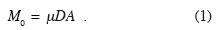
Assuming a shear modulus for granitic rocks of μ = 3.3x10¹⁰ N/m2 and an average slip of D = lm, we estimate a rupture area of about 2,200 km2. Considering the spatial distribution of aftershocks and the distance between the two major seismic events that followed the large earthquake (Figure 1), we infer that the length of the rupture is about 120 km. Therefore, from equation 1 we estimate that the rupture area may extend down to about 18 km for a vertical fault, or about 16 km for a fault with a dip angle of 60°. This rough estimation of the thickness of the seismogenic zone is in good agreement with a depth estimate of 16 ± 2 km to the base of the crustal magnetic layer from spectral analysis of magnetic anomalies, and 19 km from maximum hypocenter depths in this region (García–Abdeslem et al., 2001), suggesting that this earthquake broke the whole brittle crustal layer zone.
Changes in the crustal stress field accompanying earthquake activity may induce crustal deformation as well as piezo remanent magnetization of the crustal magnetic layer. Therefore, as changes in remanence cause changes of the Earth's magnetic field, many efforts have been made since historic times to relate temporal changes in the geomagnetic field to seismic activity, i.e., the seismomagnetic effect (Rikitake, 1976).
The search for possible seismomagnetic precursors to large earthquakes has been conducted in tectonically active regions, such as southern California (Johnston et al., 1985; Johnston et al., 1994; Johnston et al., 2006), in Central Italy (Mele et al., 1994; Di Mauro et al., 2005), and Japan (Sasai and Ishikawa, 1980; Sasai and Ishikawa, 1997; Nishida et al., 2004). In this search, an array of magnetometers is deployed for several years at carefully selected sites located in regions of low magnetic field gradient, and across major geologic structures. However, as the main problem detecting seismomagnetic effects is their small amplitude with respect to diurnal variations of the geomagnetic field (i.e., Stacey, 1964; Sasai, 1994; Sasai, 2001), the magnetic field difference between a magnetic station located close to an active fault and a reference station are analyzed (i.e., Sasai and Ishikawa, 1980; Mele et al., 1994; Johnston et al., 1994; Nishida et al., 2004; Di Mauro et al., 2005; Johnston et al., 2006).
A considerable research effort on the seis–momagnetic phenomena is currently conducted using ultra low frequency (ULF) electromagnetic signals (EMS) in tectonically active regions such as California (Fraser–Smith et al., 1990; Kappler et al., 2010), Japan (Ismaguilov et al., 2001; Kotsarenko et al., 2005a; Serita et al., 2005; Hayakawa et al., 2008), China (Ida et al., 2008), and Mexico (Ramírez–Rojas et al., 2004; Kotsarenko et al., 2004; Kotsarenko et al., 2005b; Ramírez–Rojas et al., 2007; Ramírez–Rojas et al., 2008). Part of the problem when using ULF–EMS is to discriminate the part of the signal related to the earthquake cycle, from ionosphere signals and cultural noise. A variety of methods have been proposed: polarization analysis, involving measurements of the three magnetic components (Z, H and D) and its ratios (Hayakawa et al., 1996; Kotsarenko et al., 2004; Kotsarenko et al., 2005a; Ida et al., 2008), fractal analysis of the power spectrum of the geomagnetic signals (Hayakawa et al., 1999; Ramírez–Rojas et al., 2004; Ramírez–Rojas et al., 2007; Ramírez–Rojas et al., 2008; Kotsarenko et al., 2004; Kotsarenko et al., 2005a), spectral analysis of geomagnetic resonant structures and micro–pulsations (Hayakawa et al., 2008; Kotsarenko et al., 2004; Kotsarenko et al., 2005b; Kotsarenko et al., 2008), and the principal component analysis, which is based in the calculus of eigenvalues from geomagnetic components registered at several stations (Kotsarenko et al., 2005a).
In our case, as we have only one total–field magnetic station, we analyze our data using a statistical measure that we have called index of magnetic variation (Imv), to search for a possible seismomagnetic effect related to the El Mayor–Cucapah earthquake. This analysis is presented in two sections. In the first section we show the consistency between the total–field magnetic measurements recorded at magnetometers deployed at Ensenada, hereafter referred as EDA–B1 and EDA–B2, and their similarity with magnetograms recorded at geomagnetic observatories located at Tucson (TUC), Arizona, and Fresno (FRN), California. In the second section we define and state the assumptions behind the Imv, and use it to search for a possibly seismomagnetic effect related to the El Mayor–Cucapah earthquake. At the current state of our analysis, we suggest the possibility of having detected a seismomagnetic effect that starts some 40 minutes before the earthquake, while the large variations in the Imv, observed from the day after the earthquake were due to a strong solar wind shock that caused a geomagnetic storm.
Reliability of magnetic data recorded at Ensenada
The total–field magnetic data recorded at EDA–Bj and EDA–B2 are shown in figures 3a and 3c, respectively. There is a constant difference in amplitude of about 300 nT between the recorded data sets, which is attributed to local differences in building framework. Except for this difference, the fine variations in the observed geomagnetic field are essentially the same, as shown in figures 3b and 3d.
To ensure the reliability of the total–field magnetic data recorded at Ensenada, we compare the data recorded at magnetometer EDA–B2 with magnetograms recorded at magnetic observatories TUC and FRN. These magnetic observatories (see its location in Figure 1) are members of INTERMAGNET, an international network of magnetic observatories whose data are available on line (http://www.intermagnet.org). It is worth to mention that the distances between Ensenada–Tucson and Ensenada–Fresno are about 550 and 635 km, respectively, whereas the distances between the epicenter zone and Ensenada, Tucson and Fresno are about 135, 415 and 640 km, respectively. After removing the daily average, these data were set up in a LT basis. Their comparison (Figure 4) shows that both the long and the short period variations of the geomagnetic field recorded at Ensenada are similar to those recorded at TUC and FRN magnetic observatories, and thus validate the long term performance of the GEMTM magnetometers.
The search for a seismomagnetic effect
The raw magnetic data recorded in Ensenada by magnetometers EDA–B1 and EDA–B2, plotted on a LT daily basis are shown in figures 5 and 6, respectively. The data recorded before the main earthquake, as shown in figures 5a and 6a, have a regular and stable daily variation. The smallest variations occur during night time, and a diurnal minimum is observed regularly between 8 to 16 h.
As shown in figures 5b–c and 6b–c, the total–field magnetic data recorded since the day of the main earthquake show a remarkable change as compared to previous days. The magnetic field is particularly different the day of the main earthquake, denoted by the dark–blue line in figures 5b and 6b. Note that the major differences occur between 8 and 16 h. It is apparent from figures 5c and 6c that the magnetic field tends to recover the variation shown in days before the main earthquake.
The magnetic data recorded at Ensenada shows that locally, the geomagnetic field changed its normal variation since the day of the main earthquake, suggesting a causal relationship between the physical changes that lead to the seismic activity and changes in the geomagnetic field. Therefore, with the purpose of better describing the changes in the geomagnetic field during the time before and after the main earthquake, we perform basic statistics on the total–field magnetic data that is described next.
We assume that the average of the magnetic field, FA, recorded during the days before the main earthquake, represents the diurnal variation of the geomagnetic field during a magnetically quite–day. It was calculated using the magnetic data recorded from March 27 to April 3 at Ensenada, and it was used as a reference to quantitatively outline the magnetic field variations in all of the recorded data, according with the following statistical measure.

In equation 2, Imv stands for index of magnetic variation, being the root–mean–square of the difference between the recorded magnetic field, F, and the assumed diurnal variation on a magnetically quite day, FA. N is the number of data used in the calculation.
To compute Imv we selected the total–field magnetic data recorded at EDA–B2 shown in Figure 7a. The assumed magnetically quite diurnal variation computed from EDA–B2 data, is shown in Figure 7b along with the magnetic data recorded on April 4 to emphasize their differences. The values of Imv shown in Figure 7c were calculated over 60 minutes segments (N = 60) without overlap. This calculations show that during the days before the main earthquake, from March 27 to April 3, the Imv is of about 0.02%. From the day of the main earthquake, April 4, the Imv starts to rise, reaching a maximum greater than 0.1% on April 5. Hereafter the Imv shows strong oscillations while decreases in amplitude and it goes back to low values of about 0.02% on April 17.
Following the procedure outlined above, we use total–field magnetic data from FRN and TUC on a LT basis, to compute the Imv since March 27 until April 19. As shown in figures 8 and 9, we found a remarkable similarity with the Imv calculated using EDA–B2 data. Therefore, at the earlier stages of the analysis we suggested the proposed index of magnetic variation (Imv) as a good measurement of seismomagnetic effects (García–Abdeslem and Fregoso–Becerra, 2010; Fregoso–Becerra and García–Abdeslem, 2010). However, than ks to the suggestion of the reviewers we look at geomagnetic field disturbances described by the Dst index. We downloaded the Dst index from Kioto geomagnetic center (http://www.kugi.kyoto–u.ac.jp). The Dst or disturbance storm time index, is a measure of geomagnetic activity used to assess the severity of magnetic storms. Dst is expressed in nT and it represents the average value of the horizontal component of the Earth's magnetic field, during one hour, at four near–equatorial geomagnetic observatories. To our surprise we found that Dst indicates the onset of a magnetic storm beginning on April 5, and we include it in Figures 7, 8 and 9.
Furthermore, at 9:15 UTC on April 5, the Solar and Heliospheric Observatory (SOHO: http://sohowww.nascom.nasa.gov) reported that a strong solar wind shock was observed at SOHO at 7:59 UTC with solar wind speed abruptly increasing (from 453–538 km/s) to near 700 km/s. The SOHO spacecraft moves around the Sun in step with the Earth, by slowly orbiting around the first Lagrangian Point (LI), where the combined gravity of the Earth and Sun keep SOHO in an orbit locked to the Earth–Sun line. The LI point is approximately 1.5 million km away from Earth (about four times the distance of the Moon). Near 8:35 UTC (01:35 LT) on April 5 a geomagnetic storm was in progress.
With the aim of discard a global magnetic event previous to the earthquake, we analyzed total–field magnetic data from Intermagnet magnetic observatory VIC, located at Victoria, British Columbia, Canada, which is at about 1,875 km away from the earthquake epicenter. The magnetic field recorded at VIC (Figure 10) presents a regular diurnal variation and remains stable on several days before the earthquake, but shows a severe change caused by the magnetic storm of April 5, when the magnetic field decreases down some –300 nT. The Imv reaches up to 0.38% on April 5, during the sudden commence of the magnetic storm and 0.18% during its climax on April 6. Therefore, considering both Dst and the Imv calculated from VIC magnetic data, we discard so far the possibility of global magnetic event previous and during the El Mayor–Cucapah earthquake.
However, as the geomagnetic storm began about 10 h after El Mayor–Cucapah earthquake, and the Imv indicates a possible seismomagnetic event that begins some 40 minutes before the earthquake, we select the magnetic data recorded from April 3 to April 5 at EDA–B2, TUC, and FRN, and increase the resolution of our estimate computing the Imv at 20 minutes intervals (i.e., N = 20) for each data set. The computed Imv and the Dst index are shown in figures 11a–b, respectively.
On April 3, a magnetically quiet day without significant seismic activity, the Imv varies erratically for the three magnetic data sets, with maximum values of about 0.03%. During this day there is only one simultaneous increase (i.e., on the three data sets) of the Imv at around 22:40 h. The Dst index for this day is stable with minimum values around –10 nT.
Beginning April 4 and until 8:30 h the Imv varies from 0.01 % to about 0.02%. From 8:30 to 11:30 h the Imv shows a simultaneous increase that is grater in Ensenada (0.03%) and minimum in Fresno (0.02%), which is followed by an erratic behavior from 11:30 to 15 h. At around 15 h the Imv starts to rise and simultaneously reach 0.035 % at the time of the earthquake (15:40 h), reaching maximum values at 16:10 h. Hereafter the Imv starts to decline having values less than 0.01% at 17:50 h. Another simultaneous rise of the Imv is observed around 22:30 h. Notice in Figure 11b that on April 4 the Dst index is stable with minimum values around –15 nT.
On April 5 the variation of the Imv is simultaneous on the three magnetic data sets but presents appreciably larger values in Ensenada. The Dst index suggests a sudden commencement of the magnetic storm around 01 to 02 h (LT) in good agreement with SOHO forecast. Hereafter the Dst index continuously decreases down to –60 nT, indicating the beginning of the main phase of the geomagnetic storm.
Seems worth to emphasize that the proposed Imv is not a tool to forecast or predict an earthquake. It is a statistical measure that helps to discriminate magnetic variations that may be related either with the seismic cycle or else with geomagnetic perturbations, from an assumed quite and local diurnal variation of the geomagnetic field. The search for a seismomagnetic effect related to El Mayor–Cucapah earthquake, based upon the Imv, suggests the possibility of having detected a seismomagnetic effect that lasted about 3 h, and a precursor event 40 minutes before the earthquake.
Conclusions
We attempt to find a seismomagnetic effect caused by El Mayor–Cucapah earthquake, using total–field magnetic data recorded at a single station far away from the epicenter zone. For this endeavor an assumption was made considering that the average of magnetic data on several seismically quite days, previous to the main earthquake, represents the diurnal variation on a magnetically quite day. We define and propose the index of magnetic variation (Imv); this statistical measure is robust in the presence of noise, and yields the percent change between the observed magnetic field and the assumed diurnal variation on magnetically quite day. The Imv calculated on magnetic data recorded at Ensenada, Baja California; Fresno, California, and Tucson, Arizona, are remarkable similar, and show a sensible increase the day after the main earthquake, which certainly is caused by a magnetic storm.
The absence of solar wind perturbations and quiet daily variation of the geomagnetic field observed several days before the earthquake, in contrast with the abrupt and simultaneous change of the Imv observed on April 4, some 40 minutes before the earthquake, suggests the possibility of having detected a precursor event. This conclusion is supported by the absence of a global magnetic event the day of the earthquake, as inferred from the Imv calculated using VIC magnetic data and by the Dst index.
Acknowledgements
We acknowledge the review and comments on an earlier version of the manuscript by Ewa Glowacka Nita, Mario González Escobar and Luis Munguía Orozco. We are in debt with two anonymous reviewers who suggested the use of the disturbance storm time index and provided a list of significant references. Figure 1 was made with the generous help of Victor M. Frías Camacho. We also thank CONACYT and CICESE for supporting the operation of RESNOM (Red Sismológica del Noroeste de México), to USGS for supporting the operation of NEIC (The National Earthquake Information Center) and magnetic observatories at Tucson and Fresno, to INTERMAGNET (http://www.intermagnet.org) for promoting high standards of magnetic observatory practice, to NASA–ESA for SOHO space weather forecast, and Kyoto geomagnetic center.
Bibliography
Aki K., 1966, Generation and propagation of G–waves from the Niigata earthquake of June 16, 1964. Part 2. Estimation of earthquake moment, released energy, and stress–strain drop from the G–waves spectrum, Bull. Earthquake Res. Inst., Tokyo Univ., 44, 73–88. [ Links ]
Axen G.J., Fletcher J.M., Cowgill E., Murphy M., Kapp P., MacMillan I., Ramos–Velázquez E., Aranda–Gómez J., 1999, Range–front fault scarps of the Sierra El Mayor, Baja California: Formed above an active low–angle normal fault?, Geology, 27, 247–250. [ Links ]
Barnard F.L., 1968, Structure and tectonics of the Sierra Cucapah, Northeastern Baja California and Imperial County, California, Ph. D. thesis. University of Colorado, Boulder. [ Links ]
Di Mauro D., Lepidi S., Meloni A., Palangio P., 2005, Magnetic and Electromagnetic signals related to tectonic activity: updates and new analyses on measurements in Central Italy, Nat. Haz. Earth Sys. Sci., 5, 925–930. [ Links ]
Fletcher J.M., Spelz R.,M., 2009, Patterns of Quaternary deformation and rupture propoagation associated with an active low–angle normal fault, Laguna Salada, Mexico: evidence of a rolling hinge?, Geosphere, 5, 385–407. [ Links ]
Fraser–Smith A.C., Bernardi A., McGill P.R., Ladd M.E., Helliwell R.A., Villard O.G. Jr., 1990, Low–frecuency magnetic field measurements near the epicenter of the Ms 7.1 Loma Prieta earthquake, Geophys. Res. Let, 17, 1465–1468. [ Links ]
Fregoso–Becerra E., García–Abdeslem J., 2010, Efecto sismomagnético relacionado al terremoto El Mayor–Cucapah (Mw 7.2) del 4 de Abril de 2010. Reunión Anual 2010, Unión Geofísica Mexicana (Resumen), GEOS, 30, p. 146, Puerto Vallarta, Jalisco, México del 7 al 12 de noviembre de 2010. [ Links ]
Gastil R.G., Phillips R.H., Allison E.C., 1975, Reconnaissance geology of the State of Baja California, Geol. Soc. Am., Memoir 140. [ Links ]
García–Abdeslem J., Espinosa–Cardeña J.M., Munguía–Orozco L., Wong–Ortega V.M., Ramírez–Hernández J., 2001. Crustal structure from 2–D gravity and magnetic data modeling, magnetic power spectrum inversion, and seismotectonics in the Laguna Salada basin, northern Baja California, México, Geofísica Internacional, 40, 67–85. [ Links ]
García–Abdeslem J., Fregoso–Becerra E., 2010, Seismomagnetic effect from El Mayor–Cucapah earthquake (Mw 7.2) of April 4, 2010, in NE Baja California, México (Abstract). Electromagnetic studies of earthquakes and volcanoes (EMSEV workshop). Chapman University, Schmid College of Science, Orange County, California, USA, October 3–6, 2010. [ Links ]
Hayakawa M., Kawate R., MolchanovO.A., Yumoto K., 1996, Results of ultra–low–frecuency magnetic field measurements during the Guam earthquake of 8 August 1993, Geophys. Res. Let., 23, 241–244. [ Links ]
Hayakawa M., Ito T., Smirnova N., 1999, Fractal analysis of ULF geomagnetic data associated with the Guam earthquake on August 8, 1993, Geophys. Res. Let. 26, 2,797–2,800. [ Links ]
Hayakawa M., Nickolaenko A.P., Sekiguchi M., Yamashita K., Ida Y., Yano M., 2008, Anomalous ELF phenomena in the Schumann resonance band as observed at Moshiri (Japan) in possible association with an earthquake in Taiwan, Nat Haz. Earth Sys. Sci., 8, 1,309–1,316. [ Links ]
INEGI (Instituto Nacional de Estadística Geografía e Informática), 1980a. Carta geológica Tijuana, I11–11, escala 1:250,000. Secretaría de Programación y Presupuesto, México, D.F. [ Links ]
INEGI (Instituto Nacional de Estadística Geografía e Informática), 1980b. Carta geológica Mexicali, I11–11, escala 1:250,000. Secretaría de Programación y Presupuesto, México, D.F. [ Links ]
Ida Y., Yang D., Li Q., Sun H., Hayakawa M., 2008, Detection of ULF electromagnetic emissions as a precursor to an earthquake in China with an improved polarization analysis, Nat. Haz. Earth Sys. Sci. 8, US–Ill. [ Links ]
Ismaguilov V.S., Yu. A. Kopytenko, Hattori K., Voronov P.M., Molchanov O.A., Hayakawa M., 2001, ULF magnetic emissions connected with under sea bottom earthquakes. Nat. Haz. Earth Sys. Sci., 1, 23–31. [ Links ]
Johnston M.J.S., Silverman S.A., Mueller R.J., Breckenridge K.S., 1985, Secular variation, crustal contribution, and tectonic activity in California, 1976–1984, J. Geophys. Res., 90, 8,707–8,717. [ Links ]
Johnston M.J.S., Mueller R.J., Sasai Y., 1994, Magnetic field observations in the near–field of the 28 June 1992 Mw 7.3 Landers, California, earthquake, Bull. Seism. Soc. Amer. 84, 792–798. [ Links ]
Johnston M.J.S., Sasai Y., Egbert G.D., Park S.K., 2006, Seismomagnetic effects from the long–awaited 28 September 2004 M 6.0 Parkfield earthquake, Bull. Seis. Soc. Am., 96, 206–220. [ Links ]
Kappler K.N., Morrison H.F., Egbert G.D., 2010, Longterm monitoring of ULF electromagnetic fields at Parkfield, California, J. Geophys. Res., 115, B04406. [ Links ]
Kotsarenko A., Pérez–Enríquez R., López–Cruz–Abeyro J.A., Koshevaya S., Grimalsky V., Zuniga F.R., 2004, Analysis of the ULF electromagnetic emission related to seismic activity, Teoloyucan geomagnetic station, 1998–2001. Nat. Haz. Earth Sys. Sci., 4, 679–684. [ Links ]
Kotsarenko A., Molchanov O., Hayakawa M., Koshevaya S., Grimalsky V., Pérez–Enríquez R., López–Cruz–Abeyro J.A., 2005a, Investigation of ULF magnetic anomaly during Izu earthquake swarm and Miyakejima volcano eruption at summer 2000, Japan. Nat. Haz. Earth Sys. Sci., 5, 63–69. [ Links ]
Kotsarenko A., Molchanov O., Perez–Enríquez R., López–Cruz–Abeyro J.A., Koshevaya S., Grimalsky V., Kremenetsky I., 2005b, Possible seismogenic origin of changes in the ULF EM resonant structure observed at Teoloyucan geomagnetic station, Mexico, 1999–2001. Nat. Haz. Earth Sys. Sci., 5, 711–715. [ Links ]
Kotsarenko A., Grimalsky V., Koshevaya S., Pérez–Enríquez R., Yutsis V., López–Cruz–Abeyro J.A., Villegas Cerón R.A., 2008, Evidence of a new electromagnetic resonance discovered at Teoloyucan geomagnetic station, México?, Geofísica Internacional 47, 287–293. [ Links ]
Mele J., Meloni A., Palangio P., 1994, A tectonomagnetic effect detected in Central Italy, Annali di Geofísica, 37, 17–25. [ Links ]
Mueller K.J., Rockwell T.R., 1991, Late Quaternary structural evolution of the western margin of the Sierra Cucapa, Baja California Norte: in Dauphin, J., and Simoneit, B., (ed) The Gulf and Peninsular Province of the Californias, AAPG Memoir 47, 249–260. [ Links ]
Mueller K.J., Rockwell T.R., 1995, Late Quaternary activity of the Laguna Salada fault in northern Baja California, Mexico, Geolog. Soc. Am. Bull., 107, 818. [ Links ]
Nishida Y., Sugisaki Y., Takahashi K., Utsugi M., Oshima H., 2004, Tectonomagnetic study in the eastern part of Hokkaido, NE Japan: Discrepancy between observed and calculated results, Earth Plan. Space 56, 1,049–1,058. [ Links ]
Ramírez–Rojas A., Muñoz–Diosdado A., Pavía–Miller C.G., Angulo–Brown F., 2004. Spectral and multifractal study of electroseismic time series associated to the Mw=6.5 earthquake of 24 October 1993 in Mexico, Nat. Haz. Earth Sys. Sci., 4, 703–709. [ Links ]
Ramírez–Rojas A., Flores–Márquez E.L., Guzmán–Vargas L, Márquez–Cruz J., Pavía–Miller C.G., Angulo–Brown F., 2007, A comparison of ground geoelectric activity between three regions of different level of seismicity, Nat. Haz. Earth Sys. Sci., 7, 591–598. [ Links ]
Ramírez–Rojas A., Flores–Márquez E.L., Guzmán–Vargas L, Gálvez–Coyt G., Telesca L., Angulo–Brown R., 2008, Statistical features of seismoelectric signals prior to M7.4 Guerrero–Oaxaca earthquake (México), Nat. Haz. Earth Sys. Sci., 8, 1,001–1,007. [ Links ]
Rikitake T., 1976, Earthquake prediction. Elsevier, Amsterdam. [ Links ]
Sasai Y., 1994, Piezomagnetic fields produced by dislocation sources, Surv. Geophys., 15, 363–382. [ Links ]
Sasai Y., 2001, Tectonomagnetic modeling based on the piezomagnetism: A review, Annali di Geofísica, 44, 361–368. [ Links ]
Sasai Y., Ishikawa Y., 1980, Tectonomagnetic event preceding a M5.0 earthquake in the Izu Peninsula–Aseismic slip of a buried fault?, Bull. Earthq. Res. Inst., Univ. Tokyo 55, 895–911. [ Links ]
Sasai Y., Ishikawa Y., 1997, Seismomagnetic models for earthquakes in the eastern part of Izu Peninsula, Central Japan, Annali di Geofísica, 40, 463–478. [ Links ]
Serita A., Hattori K., Yoshino C., Hayakawa M., Isezaki N., 2005, Principal component analysis and singular spectrum analysis of ULF geomagnetic data associated with earthquakes, Nat. Haz. Earth Sys. Sci., 5, 685–689. [ Links ]
Siem M. E., Gastil R.G., 1994, Mid–Tertiary to Holocene extension associated with the development of the Sierra El Mayor metamorphic core complex, northeastern Baja California, Mexico. In: McGill, S. F. and Ross, T. M., eds. Geological investigations of an active margin, Geol. Soc. Am. Cordilleran Section guidebook, Redlans, California, San Bernardino County Museum Association, 107–119. [ Links ]
Stacey F., 1964, The seismomagnetic effect, Pure Appli. Geophys., 58, 2–22. [ Links ]

